- Usage in publication:
-
- Garcia formation
- Modifications:
-
- Original reference
- Dominant lithology:
-
- Limestone
- Chert
- Shale
- Sandstone
- AAPG geologic province:
-
- Orogrande basin
Summary:
Pg. 27 (table 2), 42-43 (fig. 4), 50-51. Garcia formation of Armendaris group (both new). Name introduced for all sediments between top of Whiskey Canyon lime's tone (new) below and base of Bolander group (new). Type section is composed of about 213 feet of rocks, including essentially pure highly fossiliferous limestone, argillaceous to slightly arenaceous and cherty limestones, several thin gray to red shales, and a 50-foot bed of highly conglomeratic sandstone at its base. Formation is widespread and varies considerably lithologically. Fauna includes highly developed fusulinids typical of middle part of Des Moines series in North America, including WEDEKINDELLINA and FUSULINA. Correlates in age with fusulinid collections taken from Des Moines series in AZ, UT, CO, WY, IO, KS, OK, and TX. Age is [Middle] Pennsylvanian (Des Moines).
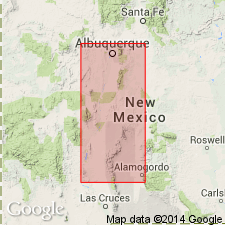
Type locality: at west end of Whiskey Canyon [now unlabeled; on west side of Cuchilla Negro Creek], just east of westernmost box canyon, in SW/4 sec. 1, T. 13 S., R. 5 W., [approx. Lat. 33 deg. 12 min. 09 sec. N., Long. 107 deg. 18 min. 36 sec. W., Cuchillo 7.5-min quadrangle], north portion of Mud Springs Mountains, Sierra Co., central NM. Named from Garcia Road, 4 to 5 mi west of Mud Springs Mountains, where well exposed, Sierra Co., central NM.
[Additional locality information from USGS historical topographic map collection TopoView, accessed May 18, 2018.]
Source: US geologic names lexicon (USGS Bull. 1200, p. 1465); supplemental information from GNU records (USGS DDS-6; Denver GNULEX).
For more information, please contact Nancy Stamm, Geologic Names Committee Secretary.
Asterisk (*) indicates published by U.S. Geological Survey authors.
"No current usage" (†) implies that a name has been abandoned or has fallen into disuse. Former usage and, if known, replacement name given in parentheses ( ).
Slash (/) indicates name conflicts with nomenclatural guidelines (CSN, 1933; ACSN, 1961, 1970; NACSN, 1983, 2005, 2021). May be explained within brackets ([ ]).

