The National Geologic Map Database is migrating to a new infrastructure. We apologize for any service disruptions during this process.
|
|---|


- Usage in publication:
-
- Garceno sandstone member
- Modifications:
-
- Original reference
- Dominant lithology:
-
- Sandstone
- AAPG geologic province:
-
- Gulf Coast basin
Summary:
Pg. 259 (fig. 2), 261-262. Garceno sandstone member of Cook Mountain formation. Name applied to basal sandstone member of formation. With exception of a 50-foot dark-colored marine shale about 150 feet above the base, member is composed of glauconitic marine sandstone beds that are highly fossiliferous. Thickness approximately 500 feet. Underlies Veleno member (new); overlies Mount Selman formaiton. Age is Eocene (Claiborne).
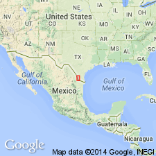
Named from Garceno ranch house, located on outcrop of the sandstone, 9 mi northwest of Zapata, Mexico. Ranch house is on American side of Rio Grande, western TX.
Source: US geologic names lexicon (USGS Bull. 1200, p. 1465).
For more information, please contact Nancy Stamm, Geologic Names Committee Secretary.
Asterisk (*) indicates published by U.S. Geological Survey authors.
"No current usage" (†) implies that a name has been abandoned or has fallen into disuse. Former usage and, if known, replacement name given in parentheses ( ).
Slash (/) indicates name conflicts with nomenclatural guidelines (CSN, 1933; ACSN, 1961, 1970; NACSN, 1983, 2005, 2021). May be explained within brackets ([ ]).