

- Usage in publication:
-
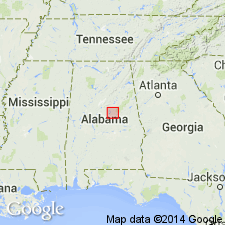
- Gantts Quarry Formation
- Modifications:
-
- Named
- Dominant lithology:
-
- Marble
- AAPG geologic province:
-
- Piedmont-Blue Ridge province
Summary:
The Gantts Quarry Formation of the Sylacauga Marble Group (as defined by Tull, 1982), is here named in the Talladega slate belt, AL. It consists of micritic, fine-grained, banded white, cream, or gray calcite marble interlayered with dolomitic marble which has been quarried for dimension stone. Overlies the Gooch Branch Chert of the Sylacauga Marble Group and unconformably underlies the Lay Dam Formation. Early Ordovician conodonts have been found near the base of the unit.
Source: GNU records (USGS DDS-6; Reston GNULEX).
- Usage in publication:
-
- Gantts Quarry Formation*
- Modifications:
-
- Biostratigraphic dating
- AAPG geologic province:
-
- Piedmont-Blue Ridge province
Summary:
The uppermost unit of the Sylacauga Marble Group (Tull, (1982), the Gantts Quarry Formation of Tull (1985), contains Early Ordovician conodonts that confirm correlation with the Newala Limestone, Kingsport Formation, and Mascot Dolomite of the Appalachian foreland.
Source: GNU records (USGS DDS-6; Reston GNULEX).
For more information, please contact Nancy Stamm, Geologic Names Committee Secretary.
Asterisk (*) indicates published by U.S. Geological Survey authors.
"No current usage" (†) implies that a name has been abandoned or has fallen into disuse. Former usage and, if known, replacement name given in parentheses ( ).
Slash (/) indicates name conflicts with nomenclatural guidelines (CSN, 1933; ACSN, 1961, 1970; NACSN, 1983, 2005, 2021). May be explained within brackets ([ ]).