

- Usage in publication:
-
- Gallup sandstone member*
- Modifications:
-
- Original reference
- Dominant lithology:
-
- Sandstone
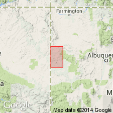
- AAPG geologic province:
-
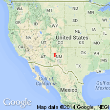
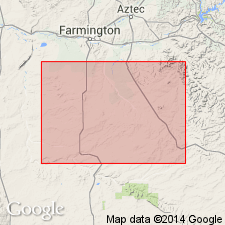
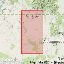
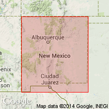
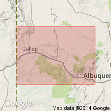
- San Juan basin
Summary:
Gallup sandstone member of Mesaverde formation. Three thick persistent cliff and ridge-forming sandstones traceable throughout Gallup-Zuni basin, northwestern New Mexico. Upper and in places lower sandstones are pink on east side of basin; all 3 are generally light-gray on west side of basin, but in places the upper sandstone is pink or red. The upper sandstone contains lenses of very coarse graines, in many places an arkose. Between the sandstones are shale. The lower shale contains several thin coal beds. The upper shale contains at most places from 1 to 3 commercial coal beds. Thickness of member 180 to 250 feet. Underlies Dilco coal member. Is basal member of Mesaverde formation in this basin. Overlies (conformably) Mancos shale. Age is Late Cretaceous.
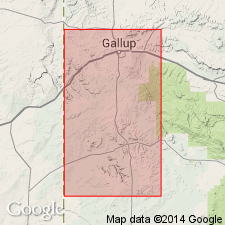
Named from town of Gallup (part of which is built upon its uppermost bed), [in T. 15 N., R. 18 W., McKinley Co.], northwestern NM.
Source: US geologic names lexicon (USGS Bull. 896, p. 794).
- Usage in publication:
-
- Gallup sandstone member
- Modifications:
-
- Areal extent
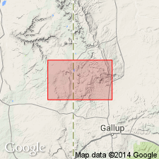
- AAPG geologic province:
-
- San Juan basin
Summary:
Pg. 11, 27-29, pls. 10, 11. Gallup sandstone member of Mesaverde formation. In the Zuni Indian Reservation and areas to north, McKinley County, northwestern New Mexico, Pescado tongue (new) of Mancos shale splits Gallup member of Mesaverde into upper and lower parts. Fossils. Age is Late Cretaceous (Niobrara).
Source: Publication; US geologic names lexicon (USGS Bull. 1200, p. 1458).
- Usage in publication:
-
- Gallup sandstone
- Modifications:
-
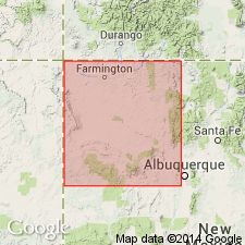
- Revised
- AAPG geologic province:
-
- San Juan basin
Summary:
Pg. 91. Gallup sandstone of Mesaverde group. Rank raised to formation in Mesaverde group. In Fort Defiance-Tohatchi quadrangles, basal unit of group; underlies Crevasse Canyon formation (new). [Age is Late Cretaceous.]
Source: US geologic names lexicon (USGS Bull. 1200, p. 1458).
- Usage in publication:
-
- Gallup sandstone*
- Modifications:
-
- Adopted
- AAPG geologic province:
-
- San Juan basin
Summary:
Pg. 2156. Gallup sandstone of Mesaverde group. Nomenclature of Mesaverde, in San Juan basin, revised. Gallup sandstone as a formation replaces Gallup sandstone member, and also, in its northward extension, replaces in its entirety Tocito sandstone lentil of Mancos shale. [Age is Late Cretaceous.]
Source: US geologic names lexicon (USGS Bull. 1200, p. 1458).
- Usage in publication:
-
- Gallup sandstone*
- Modifications:
-
- Revised
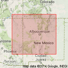
- AAPG geologic province:
-
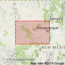
- Orogrande basin
Summary:
Pg. 187, 188 (fig. 2), 190, 191. Gallup sandstone. Cretaceous section in Alamosa Creek [now Alamocita Creek] valley area, Catron and Socorro Counties, northwestern New Mexico, reinterpreted, and stratigraphic names used in San Juan basin extended into valley. Gallup sandstone is split into upper and lower units by D-Cross tongue (new) of Mancos shale. Name Gallego sandstone retained but applied to upper sandstone member of Gallup rather than to member of Miguel formation which is herein abandoned. Overlies Mancos shale; underlies Crevasse Canyon formation (Dilco coal member). Gallup as identified, correlated, and described in this report, corresponds with only the upper part of La Cruz Peak formation of Tonking (1955) which includes also the underlying part of the Mancos down to a sandstone identified by him as Tres Hermanos (?) sandstone member of Mancos. [Age is Late Cretaceous.]
Source: US geologic names lexicon (USGS Bull. 1200, p. 1458).
- Usage in publication:
-
- Gallup Sandstone*
- Modifications:
-
- Revised
- AAPG geologic province:
-
- San Juan basin
Summary:
Gallup in the subsurface of the Bisti field, San Juan Co, NM in the San Juan basin, is divisible into the: 1) main Gallup, a widespread regressive marine sandstone with an offshore and a beach sand facies; 2) "Low SP facies"; 3) bar sand facies, three named in this report--Huerfano Sand Member, Carson Sand Member, Marye Sand Member; 4) fore-bar facies; 5) back-bar facies. Overlies, underlies, and intertongues with Mancos Shale. Cross sections. Depositional framework and petrologic studies described. High glauconite content can be used to distinguish bar sands from beach sand which lacks glauconite. Open-marine facies have planktonic Foraminifera, collophane, and INOCERAMUS in fore-bar facies that distinguishes it from back-bar facies which have restricted marine pyrite-filled benthonic Foraminifera. Vertical gradients of sandstone texture and primary dolomite grain distribution also help reconstruct the depositional history. Block diagrams show depositional history.
Source: GNU records (USGS DDS-6; Denver GNULEX).
- Usage in publication:
-
- Gallup Sandstone
- Modifications:
-
- Revised
- AAPG geologic province:
-
- San Juan basin
Summary:
The Upper Cretaceous Gallup revised in that the Sanostee Sandstone Member (first published use) recognized as a member of Gallup near Sanostee Trading Post north of Gallup, McKinley Co, NM in the San Juan basin. Depositional environment--infra-surfzone, surfzone, and beach--of Sanostee described, but intent to name, description of contacts, lithology, placement within stratigraphic sequence, areal limits, etc not discussed.
Source: GNU records (USGS DDS-6; Denver GNULEX).
- Usage in publication:
-
- Gallup Sandstone
- Modifications:
-
- Revised
- AAPG geologic province:
-
- San Juan basin
Summary:
Revised in that the upper red-pink to buff, coarse-, medium- to fine-grained sandstone named Torrivio Sandstone Member of Gallup Sandstone. Divided into (ascending): 1) lower regressive unit of mudstone, coal and sandstone of the Atarque Member; 2) F sand; 3) E sand, a pink, flat-bedded, sandstone of marine origin; 4) D sand, a buff, flat-bedded, regressive coastal barrier sandstone; 5) C sand; 6) paludal dark gray shale; and 7) the Torrivio, a fluvial braided stream sandstone. Overlies Mancos Shale. Underlies Dilco Member of Crevasse Canyon Formation. Cross sections. Thought to be a regressive clastic wedge that prograded halfway across the San Juan basin. Its source may have been in southwest AZ. Of Late Cretaceous age.
Source: GNU records (USGS DDS-6; Denver GNULEX).
- Usage in publication:
-
- Gallup Sandstone*
- Modifications:
-
- Revised
- AAPG geologic province:
-
- San Juan basin
- Orogrande basin
Summary:
Not assigned to Mesaverde Group in this area. Atarque Sandstone Member removed from Gallup and reassigned to Tres Hermanos Formation (raised in stratigraphic rank). Is separated from Tres Hermanos by Pescado Tongue between Atarque, Valencia Co., San Juan basin to Cebollita Mesa, Socorro Co, Orogrande basin. East of the mesa, F sandstone pinches out, and D-Cross Tongue of Mancos underlies E sandstone of Gallup. Is of Late Cretaceous age.
Source: GNU records (USGS DDS-6; Denver GNULEX).
- Usage in publication:
-
- Gallup Sandstone*
- Modifications:
-
- Principal reference
- Revised
- Dominant lithology:
-
- Sandstone
- AAPG geologic province:
-
- San Juan basin
Summary:
Principal reference section designated (no type designated by Sears in 1925) and measured in SE1/4 NE1/4 sec 13, T15N, R18W, McKinley Co., NM in San Juan basin. Torrivio Member, at top, adopted. At that section lower part is composed of pink to buff, very fine- to fine-grained, massive, well-sorted, highly burrowed, bioturbated sandstone, lesser amounts of dark-gray shale and siltstone 214 ft thick; some sandstone beds are ripple marked; some are flat bedded; some are low angle cross beds; is an offshore (transgressive-regressive) marine unit; Torrivio, at top, is a pink to buff medium- to coarse-grained fluvial sandstone 55 ft thick that also has a few dark gray shale beds. Ranges from 0 ft thick 60 mi northwest of Gallup to almost 400 ft in Gallup area. Overlies and intertongues with Mancos Shale. Underlies and intertongues with Crevasse Canyon Formation. Where nonmarine beds missing, top of Gallup placed at top of marine sandstone. Fauna sparse. Age ranges from early late Turonian to early Coniacian (Late Cretaceous). No longer included in Mesaverde Group. Gallup sediments derived from southern or southwest Arizona. Northern limits of Gallup shown on fig. 10. Cross sections. In west-central and southwest NM where Pescado and D-Cross Tongues of Mancos have pinched out, term Moreno Hill Formation used rather than Gallup.
Source: GNU records (USGS DDS-6; Denver GNULEX).
- Usage in publication:
-
- Gallup Sandstone*
- Modifications:
-
- Areal extent
- AAPG geologic province:
-
- San Juan basin
Summary:
Gallup Sandstone in the Zuni basin of the San Juan basin of west-central NM is divided into the 1) F sandstone, a 10-45 ft thick regressive coastal-barrier sequence at the base, 2) Ramah unit, a 130+ ft thick informally named paludal unit in the middle, and 3) Torrivio Member, a 40 to 80 ft thick unit at the top. The F sandstone of late Turonian age overlies the Pescado Tongue of the Mancos Shale. The Ramah unit includes two coal zones--one at the base and an upper zone called the School Mine coal group. The Torrivio is a distinctive red-brown, medium to very coarse grained, feldspathic, fluvial channel sandstone. Crevasse Canyon Formation overlies the Torrivio. Of Late Cretaceous age.
Source: GNU records (USGS DDS-6; Denver GNULEX).
- Usage in publication:
-
- Gallup Sandstone*
- Modifications:
-
- Biostratigraphic dating
- AAPG geologic province:
-
- San Juan basin
Summary:
Is diachronous (becoming younger in a northeastern direction), regressive sandstone in the San Juan basin in west-central NM. In western part of study area, unit is late Turonian (ammonite zones of PRIONOCYCLUS WYOMINGENSIS, SCAPHITES WHITFIELDI, and P. QUADRATUS), while in northeastern part, unit is of early Coniacian age (ammonite zones of FORRESTERIA PERUANA and F. BRANCOI). Molluscan fossils are locally abundant; bivalves being the dominant form, and ammonites are not common. Overlies Pescado Tongue of Mancos Shale in Upper Nutria area, unnamed shale member of Mancos in Gallup and Laguna-San Ysidro areas, and D-Cross Tongue of Mancos in Acoma Pueblo area. Overlain by Crevasse Canyon Formation. Figure 2 is stratigraphic nomenclature and correlation chart of middle Cenomanian to lower Coniacian rocks in west-central NM, spanning 20 ammonite zones.
Source: GNU records (USGS DDS-6; Denver GNULEX).
- Usage in publication:
-
- Gallup Sandstone*
- Modifications:
-
- Revised
- AAPG geologic province:
-
- San Juan basin
Summary:
Top of Gallup placed at top of uppermost marine sandstone bed, thereby excluding Torrivio Member and the intervening nonmarine coastal-plain part of section from Gallup. Torrivio is reassigned to lower part of overlying Crevasse Canyon Formation and redescribed as Torrivio Sandstone Member. Torrivio is a fluvial sandstone unit that is genetically and lithologically very different from underlying marine tongues of Gallup. Torrivio is an irregularly bedded sandstone with variable grain size though is characteristically coarse grained and contains granules in lower part. The marine tongues of the Gallup are generally fine grained, very well sorted, and much more uniform in lateral extent. Principal reference section for Gallup is the same as described by Molenaar (1983) except that top of Gallup is now place at top of unit 9 (D sandstone tongue). Total thickness of revised Gallup at principal reference is now 71 m. Relationships of tongues of Gallup and overlying Crevasse Canyon and underlying Mancos Shale shown in fig. 2. Assigned late Turonian and early Coniacian (Late Cretaceous) age.
Source: GNU records (USGS DDS-6; Denver GNULEX).
For more information, please contact Nancy Stamm, Geologic Names Committee Secretary.
Asterisk (*) indicates published by U.S. Geological Survey authors.
"No current usage" (†) implies that a name has been abandoned or has fallen into disuse. Former usage and, if known, replacement name given in parentheses ( ).
Slash (/) indicates name conflicts with nomenclatural guidelines (CSN, 1933; ACSN, 1961, 1970; NACSN, 1983, 2005, 2021). May be explained within brackets ([ ]).