


- Usage in publication:
-
- Galiuro volcanics*
- Modifications:
-
- Redescribed
- Dominant lithology:
-
- Andesite
- Breccia
- Rhyolite
- Tuff
- Sandstone
- AAPG geologic province:
-
- Pedregosa basin
Summary:
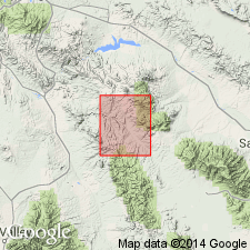
Name changed from Galiuro rhyolite to Galiuro volcanics because many rock types other than rhyolite present in the volcanic pile. Overlies the newly named middle Tertiary Threelinks conglomerate. The next younger unit in report area is a conglomerate that may be equivalent to the Gila conglomerate. Divisible into 4 members. Basal basaltic andesite member consists of basaltic andesite flows and a minor basal and middle basaltic andesite tuff breccia that together are 0-456 ft thick (measured section). The overlying latite member 0-242 ft thick consists of vitric tuff, brown to pink rhyolite (measured section). The unconformably overlying volcanic conglomerate 0-500 ft thick is known locally; this member includes tuff, volcanic breccia, and red sandstone as well as conglomerate. The upper or rhyolite member 900 ft thick is pale-brown to light-gray, resistant rhyolite or trachyte?. Galiuro mapped in this quad at northwest corner in Kelsey Canyon, in east-central part as far south as the Steele Hills, and in northeast part in Winchester Mountains, Cochise Co, AZ in the Pedregosa basin. Assigned to the middle Tertiary. Geologic map.
Source: GNU records (USGS DDS-6; Denver GNULEX).
- Usage in publication:
-
- Galiuro Volcanics*
- Modifications:
-
- Areal extent
- Revised
- Overview
- AAPG geologic province:
-
- Basin-and-Range province
Summary:
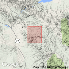
Extends along entire western edge of quad in the Basin-and-Range province. About 63 sq mi of quad underlain by Galiuro. Extends southeast for about 50 mi as well as north and west into adjoining quad. Entire formation not exposed at one locality. Divided into 12 units. Unconformably overlies Glory Hole Volcanics (new), Copper Creek Granodiorite (new), and sedimentary rocks, depending on location. Unconformably underlies Hell Hole Conglomerate (new). Age uncertain; tentatively middle Tertiary. Geologic map.
Source: GNU records (USGS DDS-6; Denver GNULEX).
- Usage in publication:
-
- Galiuro Volcanics*
- Modifications:
-
- Revised
- AAPG geologic province:
-
- Basin-and-Range province
Summary:
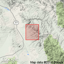
Divided into 9 mapped members which are Holy Joe Member (base), tuff of Oak Springs Canyon, andesite and conglomerate of Depression Canyon, tuff and conglomerate of Bear Springs Canyon, Aravaipa Member (new), andesite and conglomerate of Virgus Canyon, rhyolite-obsidian member, Hells Half Acre Tuff Member (new), and Apsey Conglomerate Member (new). Disconformably? overlies Tertiary Whitetail? Conglomerate. Disconformably underlies the Pliocene Gila Conglomerate. Within the Galiuro, a disconformity may occur at the base of the Aravaipa, and a disconformity does occur at the base of the rhyolite-obsidian member. K-Ar determinations on biotite and on sanidine form the Hells Half Acre Tuff, Aravaipa, and Holy Joe Members, and from the tuff of Bear Springs Canyon yielded ages of 22.4 to 25.9 m.y., or Miocene. Galiuro occurs in all but the southwest part of the quad.
Source: GNU records (USGS DDS-6; Denver GNULEX).
- Usage in publication:
-
- Galiuro Volcanics*
- Modifications:
-
- Revised
- AAPG geologic province:
-
- Basin-and-Range province
Summary:
Galiuro divided into ten mapped units (ascending): 1) andesite of Little Table Mountain; 2) Holy Joe Member (named in this report); 3) tuff of Oak Springs; 4) andesite and conglomerate of Depression Canyon; 5) tuff and conglomerate of Bear Springs Canyon; 6) Aravaipa Member; 7) andesite and conglomerate of Virgus Canyon; 8) Hells Half Acre Tuff Member; 9) Apsey Conglomerate Member; and 10) andesite of Table Mountain. Disconformably? overlies Whitetail? Conglomerate. Is older than the Gila Conglomerate. Mapped in northeast part of quad and in a small area in west-central part of quad. K-Ar determinations on biotite and sanidine from Hells Half Acre, Aravaipa, and Holy Joe Members, and from the tuff of Bear Springs Canyon yielded age of 22.4 to 25.9 m.y. (or Miocene).
Source: GNU records (USGS DDS-6; Denver GNULEX).
- Usage in publication:
-
- Galiuro Volcanics*
- Modifications:
-
- Age modified
- AAPG geologic province:
-
- Basin-and-Range province
Summary:
Galiuro Volcanics. Age changed from Miocene --to-- early Miocene. Shown on stratigraphic chart as a correlative of lower(?) Miocene San Manuel Formation, mapped west of San Pedro River.
Galiuro mapped east of San Pedro River, eastern Pinal County, Arizona (Basin-and-Range province), in Brandenburg Mountain, SW/4 Christmas (Willden, 1964, USGS Bull. 1161-E), Holy Joe Peak, and Saddle Mountain 7.5-min quadrangles; isolated outcrops along Holy Joe Peak-Lookout Mountain 7.5-min quadrangle border; Galiuro(?) mapped along Saddle Mountain-Winkelman 7.5-min quadrangle border. (See Krieger, 1968, USGS Geol. Quad Maps GQ-668, 669, 670, 671; 1973, USGS Geol. Quad Map 1106.)
Source: Publication; supplemental information from GNU records (USGS DDS-6; Denver GNULEX).
- Usage in publication:
-
- Galiuro Volcanics*
- Modifications:
-
- Areal extent
- Age modified
- Geochronologic dating
- AAPG geologic province:
-
- Basin-and-Range province
Summary:
Occurs in the Galiuro, Winchester, and Little Dragoon Mountains, AZ, Basin-and-Range province. Accumulated during a period of about 6 m.y. when volcanism was intermittent and uplift, tilting, and erosion were active. Conglomerates in formation are important, but are subordinate to other lithologies. Divisible to a lower part that is dominantly lava flows and an upper part that is dominantly ash-flow tuffs separated from each other by an erosional unconformity. Stratigraphy of the formation is complicated by the lenticularity of the units and by erosion. Seven units mapped (ascending order): 1) lower part, and 2) lower rhyolite-obsidian unit; 3) ash-flow tuff and andesite unit; 4) upper rhyolite-obsidian unit; 5) crystal, vitric, and lithic tuff; 6) Apsey Conglomerate Member; and 7) upper andesite unit. Detailed lithologic description; chemical analyses. Age ranges from about 23 to about 29 m.y., or Oligocene and Miocene based on K-Ar analyses on 11 samples of sanidine and biotite. [Was formerly assigned to the Miocene.] Geologic map; correlation diagrams.
Source: GNU records (USGS DDS-6; Denver GNULEX).
For more information, please contact Nancy Stamm, Geologic Names Committee Secretary.
Asterisk (*) indicates published by U.S. Geological Survey authors.
"No current usage" (†) implies that a name has been abandoned or has fallen into disuse. Former usage and, if known, replacement name given in parentheses ( ).
Slash (/) indicates name conflicts with nomenclatural guidelines (CSN, 1933; ACSN, 1961, 1970; NACSN, 1983, 2005, 2021). May be explained within brackets ([ ]).