The National Geologic Map Database is migrating to a new infrastructure. We apologize for any service disruptions during this process.
|
|---|


- Usage in publication:
-
- Furnace Ridge conglomerate member
- Modifications:
-
- Named
- Dominant lithology:
-
- Conglomerate
- Sandstone
- AAPG geologic province:
-
- Gettysburg basin
- Piedmont-Blue Ridge province
Summary:
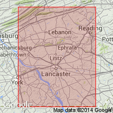
A conglomerate in the lower part of the Gettysburg lithofacies is here named the Furnace Ridge conglomerate member. It extends from Mount Hope in the west, reaches its maximum in Furnace Ridge at the Hammer Creek section, and remains prominent beyond the eastern limit of Lebanon and Lancaster Cos., PA. It consists of coarse quartz-pebble conglomerate with interbedded red quartzose sandstone. It lies between the lower and middle sandstone members of the Gettysburg. Thickness is 3,000 ft at Hammer Creek. Age is Late Triassic.
Source: GNU records (USGS DDS-6; Reston GNULEX).
- Usage in publication:
-
- Furnace Ridge Conglomerate Member†
- Modifications:
-
- Abandoned
- AAPG geologic province:
-
- Gettysburg basin
- Piedmont-Blue Ridge province
Summary:
The Hammer Creek Formation, defined between the Dauphin-Lebanon County line on the west and the Schuylkill River on the east, includes rocks previously defined as the Robeson Conglomerate and the Furnace Ridge and Elizabeth Furnace Conglomerate Members of the Gettysburg Formation. The Furnace Ridge Member is not recognized in the Hammer Creek Formation.
Source: GNU records (USGS DDS-6; Reston GNULEX).
For more information, please contact Nancy Stamm, Geologic Names Committee Secretary.
Asterisk (*) indicates published by U.S. Geological Survey authors.
"No current usage" (†) implies that a name has been abandoned or has fallen into disuse. Former usage and, if known, replacement name given in parentheses ( ).
Slash (/) indicates name conflicts with nomenclatural guidelines (CSN, 1933; ACSN, 1961, 1970; NACSN, 1983, 2005, 2021). May be explained within brackets ([ ]).