The National Geologic Map Database is migrating to a new infrastructure. We apologize for any service disruptions during this process.
|
|---|


- Usage in publication:
-
- Furnace Creek formation*
- Modifications:
-
- Named
- Dominant lithology:
-
- Fanglomerate
- Sandstone
- Shale
- Volcanics
- AAPG geologic province:
-
- Great Basin province
Summary:
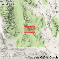
Furnace Creek formation [T.P. Thayer, unpublished] is typically exposed in Furnace Creek Wash and the eastern side of the Black Mountains, Inyo Co, CA. Type locality: Not evaluated to date. Consists largely of volcanic rocks with interbedded fanglomerate, yellowish sandstone, and tuffaceous clay shale. Most of the volcanic rocks are latitic and consist of green or gray vitrophyre and varicolored platy felsite, tuff, and breccia with a few flows of basalt. Thickness is 2500 ft. Unconformably overlies the Artist Drive formation (new); unconformably underlies the Greenwater volcanics (new). Age is late Miocene or Pliocene based on fossils [vertebrate tracks, plants].
Source: GNU records (USGS DDS-6; Menlo GNULEX).
- Usage in publication:
-
- Furnace Creek Formation*
- Modifications:
-
- Redescribed
- Age modified
- AAPG geologic province:
-
- Great Basin province
Summary:
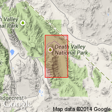
Furnace Creek Formation is exposed from the Black Hills northward to the Salt Creek Hills, Inyo Co, CA. Consists of a basal conglomerate of variable thickness, light-colored fine-grained playa beds. Some of the beds are highly tuffaceous; others are clastic sand or silt; some interbedded basalts and conglomerate beds. Basal conglomerate is composed mostly of cobbles of Paleozoic limestone and dolomite; lower playa beds contain thick deposits of gypsum and borate. At the northern end of the Black Mountains, the Furnace Creek is more than 5000 ft thick. [Conformably] overlies unnamed tuffaceous units; [unconformably] underlies the Funeral Formation. Age is Pliocene based on fossils [diatoms, plants]. [Age as shown on map is Miocene or Pliocene].
Source: GNU records (USGS DDS-6; Menlo GNULEX).

- Usage in publication:
-
- Furnace Creek Formation*
- Modifications:
-
- Age modified
- Geochronologic dating
- AAPG geologic province:
-
- Great Basin province
Summary:
Pg. 9, geologic time scale (inside front cover). Furnace Creek Formation. Sample from a fine-grained clinopyroxene-olivine basalt, at north tip of basalt cap on ridge of Lila C. Borate Mine (inactive), Lat. 36 deg. 14 min. 40 sec. N., Long. 116 deg. 29 min. 39 sec. W., Eagle Mountain quadrangle, Inyo County, California, yielded a K-Ar age of 7.35 +/-0.22 Ma (whole-rock). Sample from the lowest unaltered rock, a vitrophyre, in volcanic facies of Furnace Creek Formation (type section), on northeast flank of Black Mountains, Death Valley National Monument, Lat. 36 deg. 19 min. 53 sec. N., Long. 116 deg. 44 min. 17 sec. W., Ryan quadrangle, Inyo County, California, yielded a K-Ar age of 6.05 +/-0.18 Ma (biotite); age appears reliable. Ages calculated using decay constants of Steiger and Jager, 1977 (Earth Planet. Sci. Letters, v. 36, p. 359-362). A vitrophyre in upper part of the volcanic facies gives biotite age of 5.18 +/-0.15 Ma (J.F. McAllister, 1973, USGS Misc. Geol. Inv. Map I-782). [Miocene, based on time scale of Berggren, 1972, Lethaia, v. 5, no. 2, p. 195-215.]
Source: Publication.
For more information, please contact Nancy Stamm, Geologic Names Committee Secretary.
Asterisk (*) indicates published by U.S. Geological Survey authors.
"No current usage" (†) implies that a name has been abandoned or has fallen into disuse. Former usage and, if known, replacement name given in parentheses ( ).
Slash (/) indicates name conflicts with nomenclatural guidelines (CSN, 1933; ACSN, 1961, 1970; NACSN, 1983, 2005, 2021). May be explained within brackets ([ ]).