The National Geologic Map Database is migrating to a new infrastructure. We apologize for any service disruptions during this process.
|
|---|


- Usage in publication:
-
- Funston limestone
- Modifications:
-
- Original reference
- Dominant lithology:
-
- Limestone
- Shale
- AAPG geologic province:
-
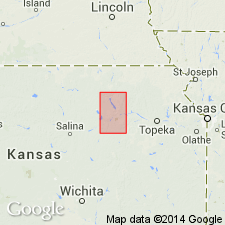
- Nemaha anticline
Summary:
Pg. 23. Funston limestone member of Garrison formation of Council Grove group. Funston limestone is new name for middle part of Speiser shale as defined by Condra in 1927. In Nebraska it consists of (descending): (1) gray limestone, 1 foot or more; (2) greenish argillaceous shale, 2 feet or more; (3) gray limestone, 1 foot or more; (4) massive arenaceous limestone that weathers yellowish, 1.5 to 2 feet. In southern Kansas the basal zone is 2 or more feet thick and becomes dominant part of the member at type locality. Underlies Speiser shale restricted and overlies Blue Rapids shale members of Garrison. Upper and middle limestone zones are fossiliferous (includes brachiopods PRODUCTUS SEMIRETICULATUS, COMPOSITA SUBTILITA, DERBYA sp., as well as ostracods, pelecypods, and bryozoans). Age is Permian (Big Blue).
Type locality: in bluffs of Kansas River Valley south of Funston, Kansas. Named from Camp Funston, Riley Co., eastern KS.
Source: US geologic names lexicon (USGS Bull. 896, p. 787); GNC KS-NE Permian Corr. Chart, Oct. 1936; supplemental information from GNU records (USGS DDS-6; Denver GNULEX).

- Usage in publication:
-
- Funston limestone member
- Modifications:
-
- Revised
- AAPG geologic province:
-
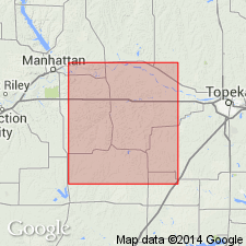
- Forest City basin
Summary:
Pg. 4, 6. Funston limestone member of Bigelow limestone formation of Council Grove gorup. Thickness 8.5 feet. Overlies Blue Rapids shale member of Bigelow and underlies Speiser formation; all included in Council Grove group. Age is Permian (Big Blue).
Source: US geologic names lexicon (USGS Bull. 896, p. 787, Bigelow entry p. 183); GNC KS-NE Permian Corr. Chart, Oct. 1936.
- Usage in publication:
-
- Funston limestone
- Modifications:
-
- Revised
- AAPG geologic province:
-
- Forest City basin
Summary:
Pg. 64-65. Condra (1935) employed term Bigelow limestone to comprise three units (ascending): Sabetha limestone (Crouse limestone), Blue Rapids shale, and Funston limestone. [The Bigelow thus included strata between the Easly Creek shale and Speiser shale. To be consistent with classification applied to strata above and below them, these beds should be divided into formations.] It is here proposed that Bigelow be dropped as stratigraphic term and that Crouse limestone, Blue Rapids shale, and Funston limestone be recognized as formations. [In Council Grove group. Age is Permian (Wolfcamp).]
Source: US geologic names lexicon (USGS Bull. 1200, p. 1444).
- Usage in publication:
-
- Funston limestone*
- Modifications:
-
- Areal extent
- AAPG geologic province:
-
- Forest City basin
Summary:
Pg. 13 (table 2), 84-86, pls. Funston limestone of Council Grove group. Described in Wabaunsee County, eastern Kansas, where it commonly consists of three thin beds of moderately hard massive limestone separated by gray beds of shale. Contains biostrome that extends into parts of four counties in east-central Kansas. Thickness 8 to about 26 feet. Overlies Blue Rapids shale; underlies Speiser shale. Age is Permian.
Source: US geologic names lexicon (USGS Bull. 1200, p. 1444).
- Usage in publication:
-
- Funston Limestone
- Modifications:
-
- Overview
Summary:
(Paleozoic Era; Permian System by H.G. O'Connor, D.E. Zeller, C.K. Bayne, J.M Jewett, and Ada Swineford, p. 47.) Funston Limestone of Council Grove Group. Light- to bluish-gray limestone separated by gray to yellowish-gray shale that commonly is abundantly fossiliferous. In southern and central Kansas outcrops, bluish-gray to grayish-black shale occurs in the lower part and locally the limestone beds contain chert. Thickness about 5 to 28 feet. Occurs above Blue Rapids Shale and below Speiser Shale, both of Council Grove Group. Age is Early Permian; Gearyan Provincial Stage (of H.G. O'Connor, 1963, AAPG Bull., v. 47, p. 1873-1877).
Source: Publication.
For more information, please contact Nancy Stamm, Geologic Names Committee Secretary.
Asterisk (*) indicates published by U.S. Geological Survey authors.
"No current usage" (†) implies that a name has been abandoned or has fallen into disuse. Former usage and, if known, replacement name given in parentheses ( ).
Slash (/) indicates name conflicts with nomenclatural guidelines (CSN, 1933; ACSN, 1961, 1970; NACSN, 1983, 2005, 2021). May be explained within brackets ([ ]).