

- Usage in publication:
-
- Funnel Creek Limestone*
- Modifications:
-
- Named
- Dominant lithology:
-
- Limestone
- AAPG geologic province:
-
- Alaska East-Central region
Summary:
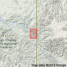
Named for exposures 1 to 3 mi south and southwest of Funnel Creek. Type area includes valley walls of three unnamed tributaries of Tatonduk River from 1 mi southwest to 3 mi south of mouth of Funnel Creek, secs.17,20,21,27,28 T2N R33E Hillard Peak area, east-central AK. Extends in nearly continuous band from Hillard Peak to Montauk Bluff. Also extends into Yukon Territory. Is massive carbonate formation, predominantly light-gray limestone with dolomite and few interbeds of dark-gray chert. Is about 1300 ft thick at type (composite stratigraphic section shown). Is thinner elsewhere, from 50 up to 500 ft thick, although much of unit is covered. Overlies Tindir Group. Underlies Adams Argillite (new). Considered to be Early Cambrian age on basis of stratigraphic relations to Tindir Group of Precambrian age..
Source: GNU records (USGS DDS-6; Menlo GNULEX).
For more information, please contact Nancy Stamm, Geologic Names Committee Secretary.
Asterisk (*) indicates published by U.S. Geological Survey authors.
"No current usage" (†) implies that a name has been abandoned or has fallen into disuse. Former usage and, if known, replacement name given in parentheses ( ).
Slash (/) indicates name conflicts with nomenclatural guidelines (CSN, 1933; ACSN, 1961, 1970; NACSN, 1983, 2005, 2021). May be explained within brackets ([ ]).