The National Geologic Map Database is migrating to a new infrastructure. We apologize for any service disruptions during this process.
|
|---|


- Usage in publication:
-
- Funks formation
- Modifications:
-
- Areal extent
- AAPG geologic province:
-
- Sacramento basin
Summary:
Funks formation. Listed as underlying Guinda formation and overlying Sites formation (both new). [Age is Late Cretaceous (Chico).]
Source: US geologic names lexicon (USGS Bull. 1200, p. 1443).
- Usage in publication:
-
- Funks formation
- Modifications:
-
- Principal reference
- Dominant lithology:
-
- Shale
- Siltstone
- AAPG geologic province:
-
- Sacramento basin
Summary:
Pg. 282, 284, 291, 293. Funks formation. Described as consisting mainly of greenish clay shale and siltstone. Thicknes 620 to 2,500 feet. Typical exposures noted.
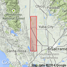
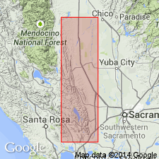
Typical exposures in vicinity of Stone Corral Creek, in W/2 sec. 27, T. 17 N., R. 4 W., and along Funks Creek, in W/2 sec. 10, T. 17 N., R. 4 W., Colusa Co., northern CA.
Source: US geologic names lexicon (USGS Bull. 1200, p. 1443).
For more information, please contact Nancy Stamm, Geologic Names Committee Secretary.
Asterisk (*) indicates published by U.S. Geological Survey authors.
"No current usage" (†) implies that a name has been abandoned or has fallen into disuse. Former usage and, if known, replacement name given in parentheses ( ).
Slash (/) indicates name conflicts with nomenclatural guidelines (CSN, 1933; ACSN, 1961, 1970; NACSN, 1983, 2005, 2021). May be explained within brackets ([ ]).