The National Geologic Map Database is migrating to a new infrastructure. We apologize for any service disruptions during this process.
|
|---|


- Usage in publication:
-
- Funeral fanglomerate*
- Modifications:
-
- Named
- Dominant lithology:
-
- Fanglomerate
- Basalt
- AAPG geologic province:
-
- Great Basin province
Summary:
Funeral fanglomerate [T.P. Thayer, unpublished]. Composed principally of fanglomerate and other arid-basin deposits, but it contains interbedded flows of basalt. Thickness 3,000 feet. Unconformably overlies all older formations; unconformably underlies flat-lying Pleistocene beds in Amargosa Valley. Age is Pliocene(?).
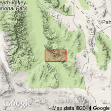
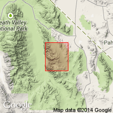
Typically exposed between the base of Funeral Range and Ryan, Inyo Co., CA. Type locality: Not evaluated to date.
Source: Modified from GNU records (USGS DDS-6; Menlo GNULEX).
- Usage in publication:
-
- Funeral formation*
- Modifications:
-
- Revised
- Age modified
- AAPG geologic province:
-
- Great Basin province
Summary:
Funeral fanglomerate (Nolan, 1941) is revised to Funeral formation based on the lithologic variability of the unit. Is [informally] divided into three interfingering members: (1) conglomerate member (conglomerate, sandstone, silt); (2) megabreccia member (coarse breccia and large masses of coherent, shattered rocks); (3) andesite and basalt member (flows, dikes, agglomerate). Unconformably overlies [unspecified] rhyolite and rhyodacite volcanic rocks and the Furnace Creek formation; unconformably underlies younger gravels. Age is Pliocene and Pleistocene(?).
Source: GNU records (USGS DDS-6; Menlo GNULEX).
- Usage in publication:
-
- Funeral Formation
- Modifications:
-
- Geochronologic dating
- AAPG geologic province:
-
- Mojave basin
Summary:
Pg. 4, geologic time scale (inside front cover). Funeral Formation. Sample collected from a fine-grained, subophitic, olivine basalt in the upper part of Funeral Formation. Whole-rock K-Ar age 4.0 +/-0.1 Ma [Pliocene]; calculated age is a minimum age. Sample no. USGS(D)TSV-383-81. Sample locality: an old railroad cut about 2 mi southeast of Travertine Point, Lat. 36 deg. 21 min. 12 sec. N., Long. 116 deg. 38 min. 48 sec. W., in T. 26 N., R. 3 E., Ryan 15-min quadrangle, Inyo Co., CA. Collected by W.J. Carr. Age determined by USGS personnel in Denver, CO (R.F. Marvin, H.H. Mehnert, E.A. Brandt). Decay constants, recommended by the IUGS Subcommission on Geochronology (Steiger and Jager, 1977, Earth and Planetary Science Letters, v. 36, p. 359-362) are used.
Source: Publication.
For more information, please contact Nancy Stamm, Geologic Names Committee Secretary.
Asterisk (*) indicates published by U.S. Geological Survey authors.
"No current usage" (†) implies that a name has been abandoned or has fallen into disuse. Former usage and, if known, replacement name given in parentheses ( ).
Slash (/) indicates name conflicts with nomenclatural guidelines (CSN, 1933; ACSN, 1961, 1970; NACSN, 1983, 2005, 2021). May be explained within brackets ([ ]).