- Usage in publication:
-
- Fullerton formation
- Modifications:
-
- Original reference
- Dominant lithology:
-
- Silt
- Clay
- AAPG geologic province:
-
- Salina basin
Summary:
Pg. 190. Fullerton formation (Aftonian), of silt and clay, 8 to 60 feet thick, rests conformably on Holdrege formation.
Source: US geologic names lexicon (USGS Bull. 896, p. 786).
- Usage in publication:
-
- Fullerton formation*
- Modifications:
-
- Principal reference
- Dominant lithology:
-
- Silt
- Clay
- Sand
- AAPG geologic province:
-
- Salina basin
Summary:
Pg. 326, 343-345; [see also Nebraska Geol. Survey Bull., no. 10, 1935]. Fullerton formation. Largely fluvial inwash-outwash deposits of dark calcareous silt and clay with some sand. Of Aftonian age (Pleistocene). Thickness 0 to 65 feet. Covers 15,000+/- sq mi. Extends continuously under Platte River Valley and plains to north and south, but exposed only in northern part of Nebraska and at Fullerton, Nance County. Occurs also in southern central part of State. Rests conformably on Holdredge formation and is overlain unconformably by Grand Island formation.
Named from exposures in vicinity of Fullerton, Nance Co., NE.
Source: US geologic names lexicon (USGS Bull. 896, p. 786).
- Usage in publication:
-
- Fullerton formation
- Modifications:
-
- Overview
Summary:
Pg. 12 (fig. 6), 16. Fullerton formation. Composed of silt and calcareous clay grading locally into fine sand. Occurs between Holdrege and Grand Island formations in Loess Plains area. Thickness varies between a few feet and 50 feet or more; average 20 to 30 feet. Grades westward into "Aftonian formation" which was developed generally on the Holdrege sand and gravel plain where subdrainage was not active. [Age is Pleistocene (Nebraskan and Aftonian).]
Source: US geologic names lexicon (USGS Bull. 1200, p. 1441).
- Usage in publication:
-
- Fullerton member
- Modifications:
-
- Revised
- Areal extent
- AAPG geologic province:
-
- Central Kansas uplift
Summary:
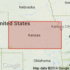
Pg. 64-65. Fullerton member of Chase Channel formation (new). Top member of Chase Channel, a subsurface unit in Rice County, western Kansas. Maximum thickness 30 feet. Gray silty clay containing much sand. Gradationally overlies Holdrege member; underlies Meade formation. Age is Pleistocene [Nebraskan and Aftonian].
Source: US geologic names lexicon (USGS Bull. 1200, p. 1441).
- Usage in publication:
-
- Fullerton member
- Modifications:
-
- Revised
- AAPG geologic province:
-
- Sedgwick basin
Summary:
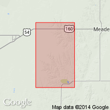
Pg. 24 (fig. 1), 51, 52 (fig. 2), 59-60, 61, 64. Fullerton member of Blanco formation. Considered upper member of Blanco formation (= Chase Channel formation of Fent) in Kansas. Where exposed in Sedgwick County, consists of 8 feet of gray to greenish-gray silt and sand and overlies Permian shale; underlies red sandy silts and silty sands tentatively classed as Crete-Loveland. Age is Pleistocene (Nebraskan and Aftonian).
Source: Publication; US geologic names lexicon (USGS Bull. 1200, p. 1441).
- Usage in publication:
-
- Fullerton member
- Modifications:
-
- Revised
- AAPG geologic province:
-
- Anadarko basin
Summary:
Pg. 55 (fig. 1). Chart of revised classification of Kansas Pleistocene shows Fullerton as member of unnamed formation in Meade group. Overlies Holdrege member; and occurs below Afton soil.
Source: US geologic names lexicon (USGS Bull. 1200, p. 1441).
- Usage in publication:
-
- Fullerton formation
- Modifications:
-
- Overview
Summary:
Fullerton formation. Shown as formation in Kansas. Age is Pleistocene (Nebraskan-Aftonian).
Source: US geologic names lexicon (USGS Bull. 1200, p. 1441).
- Usage in publication:
-
- Fullerton Formation*
- Modifications:
-
- Principal reference
- Revised
- AAPG geologic province:
-
- Salina basin
Summary:
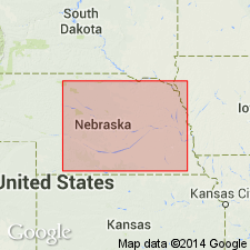
Pg. 18, 25-26; Appendix, p. 50-52. Fullerton Formation. Thickness 18.5 feet; 140+ feet in subsurface. Includes upper silt member (=Fullerton of earlier reports), 78 feet thick, and Holdrege sand and gravel member, 62+ feet thick. Underlies Afton Soil. Periglacial equivalent of Iowa Point Till. Age is early Pleistocene (late Nebraskan). Substitute type section designated. Type exposures of Lugn, 1935 (Nebraska Geol. Survey Bull., no. 10, p. 83), northwest of Fullerton, may or may not be at top of upper Nebraskan deposits.
Substitute type section: (outcrop) 2.75 mi west of Raymond along west line of NW/4 SW/4 sec. 2, T. 11 N., R. 5 E., Lancaster Co., southeastern NE; (subsurface) depth-interval 150 to 290 feet, ground water survey test hole A15-1-24aaa, 82 ft west and 9 ft south of northeast corner of sec. 24, T. 5 N., R. 1 E., Butler Co., southeastern NE.
Source: Publication.
For more information, please contact Nancy Stamm, Geologic Names Committee Secretary.
Asterisk (*) indicates published by U.S. Geological Survey authors.
"No current usage" (†) implies that a name has been abandoned or has fallen into disuse. Former usage and, if known, replacement name given in parentheses ( ).
Slash (/) indicates name conflicts with nomenclatural guidelines (CSN, 1933; ACSN, 1961, 1970; NACSN, 1983, 2005, 2021). May be explained within brackets ([ ]).

