

- Usage in publication:
-
- Fruitland formation*
- Modifications:
-
- Named
- Dominant lithology:
-
- Coal
- Sandstone
- Shale
- AAPG geologic province:
-
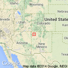
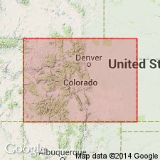
- San Juan basin
Summary:
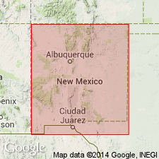
Named for town of Fruitland on the San Juan River, San Juan Co, NM in the San Juan basin. No type locality designated. Conformably overlies cliff-forming sandstone of the Pictured Cliffs sandstone. Conformably underlies gray sandy shale of the newly named Kirtland shale. Consists of sandstone, shale, and coal. Coal beds are lenticular and more persistent than the other lithologies. Coal occurs at base at most localities. Is irregularly bedded ranging changing facies laterally and vertically from sandy shale to shaly or clayey sandstone. Weathers into pillars, knobs, pyramids, and other shapes. Iron carbonate concretions commonly containing barite occur at many localities. Ranges from 192 to 292 ft thick in area. Cross section. History of nomenclature chart. Geologic map. Cretaceous age.
Source: GNU records (USGS DDS-6; Denver GNULEX).
- Usage in publication:
-
- Fruitland formation*
- Modifications:
-
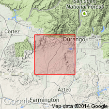
- Areal extent
- AAPG geologic province:
-
- San Juan basin
Summary:
Fruitland formation. Described in Red Mesa area, La Plata and Montezuma Counties, Colorado, where it is 510 to 520 feet thick. Occurs as a series of low ridges and valleys on the gentle backslope of the Pictured Cliffs. Consists of gray to brown to olive, fine- to medium-grained, cross-laminated and cross-bedded sandstone; dark-gray to black carbonaceous shale; green feldspathic sandy silty shale; and coal. Deposited in brackish water in coastal plain swamps and in freshwater on floodplains. Underlies Kirtland shale. Gradationally overlies Pictured Cliffs sandstone; contact placed at base of first carbonaceous sandstone or shale. Age is Late Cretaceous. Report includes geologic map, columnar section.
Source: US geologic names lexicon (USGS Bull. 1200, p. 1440); supplemental information from GNU records (USGS DDS-6; Denver GNULEX).
- Usage in publication:
-
- Fruitland Shale*
- Modifications:
-
- Revised
- Areal extent
- AAPG geologic province:
-
- San Juan Mountains province
- Paradox basin
Summary:
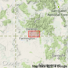
Unconformably underlies the newly named Cimarron Ridge Formation on the northwest flank of the San Juan Mountains about 17 mi north of Ouray on Spur and Cimarron Ridges, on border between Ouray (San Juan Mountain province) and Gunnison (Paradox basin) Cos, CO. Age is Late Cretaceous.
Source: GNU records (USGS DDS-6; Denver GNULEX).
- Usage in publication:
-
- Fruitland Formation*
- Modifications:
-
- Mapped 1:50k
- Dominant lithology:
-
- Sandstone
- Siltstone
- Mudstone
- Shale
- Coal
- AAPG geologic province:
-
- San Juan basin
Summary:
Is Upper Cretaceous formation mapped in San Juan Co, NM (San Juan basin). Overlies Pictured Cliffs Sandstone (Upper Cretaceous); underlies Kirtland Shale (Upper Cretaceous). Is highly variable sequence of intercalated lenticular sandstone, siltstone, mudstone, carbonaceous shale, and coal. Siltstone and mudstone are dusky yellow to moderate brown. Mudstone units generally are 5-20 ft thick, but locally are as much as 50 ft thick. Contains layers of swelling clays. White to yellowish-gray, medium-grained, friable sandstone beds of this unit are lenticular, and most are less than 10 ft thick; locally they contain sideritic ironstone concretions as large as 4 ft maximum dimension. Forms picturesque badland topography. Local individual coal beds are more than 6.5 ft thick. Red clinker beds mark the outcrops of burned coal beds. Total thickness of unit is probably less than 295 ft.
Source: GNU records (USGS DDS-6; Denver GNULEX).
- Usage in publication:
-
- Fruitland Formation*
- Modifications:
-
- Age modified
- Geochronologic dating
- AAPG geologic province:
-
- San Juan basin
Summary:
Pg. 17. Fruitland Formation (Cretaceous). Two samples from whitish tonstein layer in first coal bed of Fruitland, above Pictured Cliffs Sandstone, in T. 23 N., R. 14 W., Bisti Trading Post 7.5-min quadrangle, San Juan County, New Mexico, yielded K-Ar ages of 77.3 +/-2.9 Ma and 77.2 +/-2.8 Ma (sanidine) [late Campanian]. One sample from whitish tonstein layer in first coal bed of Fruitland, above Pictured Cliffs Sandstone and below channel sandstone, in T. 24 N., R. 16 W., Newcomb SE 7.5-min quadrangle, San Juan County, New Mexico, yielded a K-Ar age of 76.3 +/-2.7 Ma (sanidine) [late Campanian]. Ages calculated using decay constants of Steiger and Jager, 1977 (Earth Planet. Sci. Letters, v. 36, p. 359-362).
Source: Publication.
- Usage in publication:
-
- Fruitland Formation*
- Modifications:
-
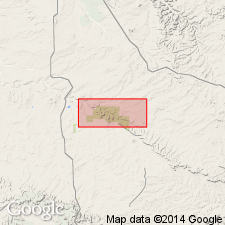
- Areal extent
- AAPG geologic province:
-
- San Juan basin
Summary:
Mapped on five cross sections in subsurface of southern La Plata Co, CO and northern San Juan Co, NM in the San Juan basin. Lower contact with Upper Cretaceous Pictured Cliffs Sandstone is intertonguing. Upper contact with Upper Cretaceous lower shale member of Kirtland Shale is intertonguing. Of Late Cretaceous age.
Source: GNU records (USGS DDS-6; Denver GNULEX).
For more information, please contact Nancy Stamm, Geologic Names Committee Secretary.
Asterisk (*) indicates published by U.S. Geological Survey authors.
"No current usage" (†) implies that a name has been abandoned or has fallen into disuse. Former usage and, if known, replacement name given in parentheses ( ).
Slash (/) indicates name conflicts with nomenclatural guidelines (CSN, 1933; ACSN, 1961, 1970; NACSN, 1983, 2005, 2021). May be explained within brackets ([ ]).