

- Usage in publication:
-
- Frio clays
- Modifications:
-
- Original reference
- Dominant lithology:
-
- Clay
- AAPG geologic province:
-
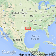
- Gulf Coast basin
Dumble, E.T., 1894, The Cenozoic deposits of Texas: Journal of Geology, v. 2, no. 6, p. 549-567.
Summary:
Pg. 554. Frio clays. Dark-colored (greenish gray, red, and blue), usually massive, gypseous clays, with laminated and bedded sandy clays, sand, and sand rock. Overlies Fayette sands (which rest on Yegua clays), and underlies Oakville (Miocene). Included in Eocene.
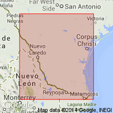
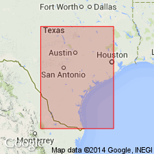
[Named from exposures at and near mouth of Frio River, Live Oak Co., eastern TX.] Typically exposed between Weedy Creek and Oakville, on Atascosa and Frio Rivers, and on the Nuecos south of Tilden, eastern TX.
Source: US geologic names lexicon (USGS Bull. 896, p. 782-783).
- Usage in publication:
-
- Frio clays
- Modifications:
-
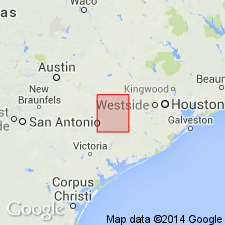
- Areal extent
- AAPG geologic province:
-
- Gulf Coast basin
Summary:
Pg. 913-987. Frio clays overlie Fayette sands and underlie Oakville beds (Miocene). Top formation of Lower Claiborne stage of Eocene.
Source: US geologic names lexicon (USGS Bull. 896, p. 782-783).
- Usage in publication:
-
- [Frio clays]
- Modifications:
-
- Areal extent
- AAPG geologic province:
-
- Gulf Coast basin
Summary:
Frio overlies Fayette and underlies Corrigan beds. Is top subdivision of Claiborne stage. [The †Corrigan beds are now called Catahoula tuff.]
Source: US geologic names lexicon (USGS Bull. 896, p. 782-783).
- Usage in publication:
-
- Frio clays
- Modifications:
-
- Areal extent
- AAPG geologic province:
-
- Gulf Coast basin
Summary:
Pg. 481-498. Frio clays overlie Fayette and unconformably underlie Jackson [so-called]. Not recognized east of Colorado River in Texas. All fossils are characteristic of Lower Claiborne.
Source: US geologic names lexicon (USGS Bull. 896, p. 782-783).

- Usage in publication:
-
- [Frio clays]
- Modifications:
-
- Areal extent
- AAPG geologic province:
-
- Gulf Coast basin
Summary:
Pg. 81, 86-87. The Frio is a formation of yellow and dark clays which weather white and are accompanied by gypsum. Contains few marine fossils. Total thickness 660+/- feet. Thins to northeast and is not found east of the Colorado and perhaps not east of San Antonio River. In La Salle and McMullen Counties it consists of greenish and pinkish red, compact, jointed clay that has small lime nodules and concretions of siliceous limestone. Lower part consists of fossiliferous brown marl. Along Rio Grande it consists of gray and green gypseous clays, with sands. The clays often weather white and contain leaf impressions and ferruginous and calcareous concretions. Outcrops in Karnes, Live Oak, McMullen, Duval, Webb, Zapata, and Starr Counties, eastern Texas. Belongs to lower Claiborne, but some geologists consider Fayette and Frio as Jackson. Frio overlies Fayette and underlies Corrigan or Catahoula and also underlies Oakville Miocene.
Source: US geologic names lexicon (USGS Bull. 896, p. 782-783).
- Usage in publication:
-
- Frio clays
- Modifications:
-
- Biostratigraphic dating
- AAPG geologic province:
-
- Gulf Coast basin
Summary:
Frio clays. Of the few marine fossils found by us in Frio clays there were none characteristic of beds later than Lower Claiborne, and it was accordingly referred to that group. There is a possibility, however, that further collections may show that it belongs to upper rather than middle Eocene [footnote p. 57].
Source: US geologic names lexicon (USGS Bull. 896, p. 782-783).
- Usage in publication:
-
- Frio formation
- Modifications:
-
- Areal extent
- AAPG geologic province:
-
- Gulf Coast basin
Summary:
Frio formation (Jackson) in Colorado County, eastern Texas, consists, in wells, of black noncalcareous gray, green, and pink, often bentonitic clay, with some beds of tuff and lignite. Dark-colored beds contain marine fossils. Shows an apparent alternation between fresh and salt water conditions, and may be partly if not largely of river-delta origin. Thickness 648 feet. Overlies Fayette (Jackson) and unconformably underlies Corrigan formation (= Catahoula sandstone).
Source: US geologic names lexicon (USGS Bull. 896, p. 782-783).
- Usage in publication:
-
- Frio clay*
- Modifications:
-
- Age modified
- AAPG geologic province:
-
- Gulf Coast basin
Summary:
Frio clay, 100 to 400 feet thick, overlies Fayette sandstone and underlies Oakville sandstone. The Frio and Fayette are both of Jackson age.
Source: US geologic names lexicon (USGS Bull. 896, p. 782-783).
- Usage in publication:
-
- Frio formation
- Modifications:
-
- Areal extent
- AAPG geologic province:
-
- Gulf Coast basin
Summary:
(March 28, 1924.) Introduced Gueydan formation for beds (of volcanic origin) unconformably overlying Frio formation and unconformably underlying Oakville sandstone.
Source: US geologic names lexicon (USGS Bull. 896, p. 782-783).
- Usage in publication:
-
- Frio clay*
- Modifications:
-
- Areal extent
- AAPG geologic province:
-
- Gulf Coast basin
Summary:
Frio clay, 235 to 705 feet thick, underlies Catahoula sandstone and overlies Fayette sandstone. Assigned to post-Claiborne Eocene.
Source: US geologic names lexicon (USGS Bull. 896, p. 782-783).
- Usage in publication:
-
- Frio group
- Modifications:
-
- Revised
- AAPG geologic province:
-
- Gulf Coast basin
Summary:
(July-Aug., 1924.) Pg. 424-436. Frio group. Gypseous clays, chiefly with sands and sandrock, which weather white, but when wet may be green, blue, red, or yellow; contain concretions of limestone with manganese dendrites. Thickness 600+/- feet. No fossils except a leaf impression, but Jackson age is indicated by fact that we have traced what we consider to be it continuation south to Conchos River in Mexico, where it forms a good part of Pomeranes Mountains, and on eastward-facing slopes of these mountains it is overlain by lower Oligocene beds. Rests unconformably on Whitsett beds, also of Jackson age, and is overlain by Oakville sandstone.
Source: US geologic names lexicon (USGS Bull. 896, p. 782-783).
- Usage in publication:
-
- Frio formation
- Modifications:
-
- Revised
- AAPG geologic province:
-
- Gulf Coast basin
Summary:
The name Frio formation is here used with a different significance from its usage by any previous writer, so far as known. It here designates those predominantly argillaceous strata which lie conformably or disconformably beneath Gueydan formation [Catahoula tuff] and conformably on Fayette formation. Thickness 0 to 250 feet. Type locality described by Dumble in 1894 occurs in upper part of Gueydan formation of present writer. The Frio of Dumble's 1903 map of Live Oak County, eastern Texas, includes most of Gueydan and practically none of Frio of present report, while in McMullen County it includes the Frio and most of lower Gueydan but excludes the beds of his type locality in Live Oak County. The Frio as defined by Dumble in 1924 is practically same as Gueydan formation. The Frio of Trowbridge [as mapped] (USGS Prof. Paper 131-D, p. 97-98, 1923) includes Frio, Oakville, and Lagarto formations along north side of Rio Grande. The Frio clay of Deussen includes Gueydan and Frio of this report. The Frio and Fayette compose Jackson group in this area.
Source: US geologic names lexicon (USGS Bull. 896, p. 782-783).

- Usage in publication:
-
- Frio clay*
- Modifications:
-
- Overview
- AAPG geologic province:
-
- Gulf Coast basin
Summary:
The †Gueydan formation has been proved to be same as the Catahoula, and is now called Catahoula tuff, since in Texas it consists chiefly of tuff.
In 1931 the name "Yeager clay" was introduced by Julia Gardner and A.C. Trowbridge (AAPG Bull., v. 15, no. 4, p. 470) for the nonvolcanic clays underlying Catahoula tuff and overlying Fayette sandstone because of the many conflicting uses of Frio clay. Later, however, it was agreed between Texas Geol. Survey and the USGS to drop the name "Yeager" and to adopt in its stead the definition of Frio clay that restricts that name to the beds beneath Catahoula tuff (= †Corrigan formation and including Fant tuff member) and above Fayette sandstone or Jackson formation. This is definition of Frio clay at present [ca. 1936] approved by the USGS and Texas Geol. Survey according to Univ. Texas Bull., no. 3232, 1933. But A.C. Ellisor (AAPG Bull., v. 17, no. 11) includes Fant tuff in Frio clay.
Source: US geologic names lexicon (USGS Bull. 896, p. 782-783).
- Usage in publication:
-
- Frio formation [outcrop]
- "Frio" [subsurface]†
- Modifications:
-
- Areal extent
- AAPG geologic province:
-
- Gulf Coast basin
Summary:
Pg. 1616-1620, 1634. Inaccurate correlation of so-called subsurface Frio with surface Frio formation noted. Name Van Vleck sands suggest to replace "Frio" in subsurface.
Source: US geologic names lexicon (USGS Bull. 1200, Frio Stage entry p. 1433-1434).
- Usage in publication:
-
- [Frio clay]
- Modifications:
-
- Overview
- AAPG geologic province:
-
- Gulf Coast basin
Summary:
Annotated bibliography of pertinent papers dealing with term Frio; also shows various uses of term as interpreted by the reviewer.
Source: US geologic names lexicon (USGS Bull. 1200, p. 1433).
- Usage in publication:
-
- Frio clay
- Modifications:
-
- Areal extent
- AAPG geologic province:
-
- Gulf Coast basin
Summary:
Anahuac formation (new) lies between basal sands of Fleming above and subsurface Frio below.
Source: US geologic names lexicon (USGS Bull. 1200, p. 1433).
- Usage in publication:
-
- Frio clay
- Modifications:
-
- Areal extent
- AAPG geologic province:
-
- Gulf Coast basin
Summary:
Pg. 11 (fig. 2), 14. Frio clay discussed in report on uranium-bearing rocks, Karnes County area, eastern Texas. Believed to be present in subsurface beneath Catahoula tuff in central and southern Karnes County. Formation consists of light-greenish-gray clay that is bentonitic and slightly calcareous and which weathers to a characteristic brown silty or clayey soil. Although its strike is apparently same as that of underlying beds, the Frio is believed to rest unconformably on sands of Jackson formation. Downdip from outcrop, lower part of Frio of subsurface contains fauna characteristic of Vicksburg of east Gulf Coastal Plain and formation is therefore classed as Oligocene(?) in age. Thickness about 200 feet (well data in Karnes County).
Source: US geologic names lexicon (USGS Bull. 1200, p. 1433).
- Usage in publication:
-
- Frio stage (subsurface)
- Frio formation (subsurface)
- Modifications:
-
- Areal extent
- AAPG geologic province:
-
- Gulf Coast basin
Summary:
Pg. 221-227. Plummer [1933] and Ellisor (1933) used Frio as term for subsurface strata thought to be equivalent to surface beds of same name as restricted and defined by Plummer. However, it has been determined that surface Frio of Texas is outcrop equivalent of subsurface Vicksburg. Suggested that term Frio could be suppressed in case of the surface Vicksburgian equivalent in Texas and another name applied to that unit. [See also under Frio Stage (Frio Formation).]
Source: US geologic names lexicon (USGS Bull. 1200, p. 1433).
- Usage in publication:
-
- Frio clay*
- Modifications:
-
- Areal extent
- AAPG geologic province:
-
- Gulf Coast basin
Summary:
Pg. 2634. Discussion of Jackson group of south-central Texas. Southwest from point in northern Live Oak County, near community of Esseville, Frio clay, of Oliogocene(?) age, extends to the Rio Grande. This usage of Frio is in the sense that Bailey (Univ. Texas Bull., no. 2645, 1926) described the formation, restricting it to clays that lie conformably on the Jackson and that are overlain unconformably by Catahoula tuff (the Gueydan formation of Bailey).
Source: US geologic names lexicon (USGS Bull. 1200, p. 1433).

- Usage in publication:
-
- Frio Formation
- Modifications:
-
- Mapped 1:250k
- Dominant lithology:
-
- Clay
- AAPG geologic province:
-
- Gulf Coast basin
Summary:
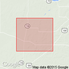
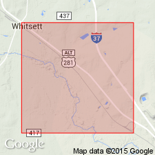
Frio Formation. Clay, dark greenish gray, massive, some gypsum and calcareous concretions. Thickness about 200 feet, feathers out northward [beyond headwaters of West Weedy Creek, in northernmost Live Oak County]. Lies above Whitsett Formation (Eocene), uppermost formation of Jackson Group, and below Catahoula Formation (Miocene). Age is Oligocene.
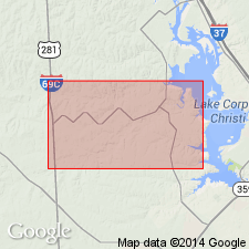
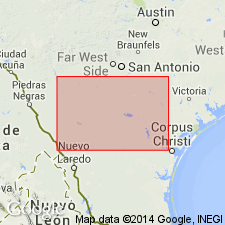
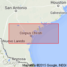
[Mapped in Duval, McMullen, and Live Oak Cos., southern TX.]
Source: Publication.
For more information, please contact Nancy Stamm, Geologic Names Committee Secretary.
Asterisk (*) indicates published by U.S. Geological Survey authors.
"No current usage" (†) implies that a name has been abandoned or has fallen into disuse. Former usage and, if known, replacement name given in parentheses ( ).
Slash (/) indicates name conflicts with nomenclatural guidelines (CSN, 1933; ACSN, 1961, 1970; NACSN, 1983, 2005, 2021). May be explained within brackets ([ ]).