- Usage in publication:
-
- Frijole limestone [member]
- Modifications:
-
- Named
- Dominant lithology:
-
- Limestone
- AAPG geologic province:
-
- Orogrande basin
- Permian basin
Summary:
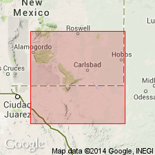
Named as top member of Delaware Mountain formation in Guadalupe Mountains, Otero Co, NM, Orogrande basin. Origin of name not stated; no type locality designated. Is a dark, shaly limestone; extremely persistent--is recognizable in well cuttings as far east as western Winkler Co, TX. Below Frijole, deep in the sandstone section, other limestone members are present that lithologically are practically indistinguishable from Frijole. Beede (1923) measured a section in Blk. 76, Culberson Co, TX of the Delaware sand, including upper dark limestone member (Frijole). The proportion of limestone in the upper part of the section increases southward from this locality. From Guadalupe Point in Culberson Co to Carlsbad, NM, a prominent escarpment of dolomite and dolomitic limestone occurs. Deep canyons are cut into the scarp at intervals by drainage channels. From the first canyon north of the NM-TX State Line to Guadalupe Point, upper part of Delaware sand section, capped by Frijole, abruptly loses its identity and is replaced by a massive, light-colored, non-bedded dolomite (Capitan limestone). This change is due to the Bone Springs arch, which acted as a barrier between desiccating seas on the north and normal seas on the south; reef-building agencies deposited great mass of Capitan. The sudden lithologic change is due to sands of Delaware Mountain washing up against the reef barrier. Permian age. Stratigraphic chart.
Source: GNU records (USGS DDS-6; Denver GNULEX).
For more information, please contact Nancy Stamm, Geologic Names Committee Secretary.
Asterisk (*) indicates published by U.S. Geological Survey authors.
"No current usage" (†) implies that a name has been abandoned or has fallen into disuse. Former usage and, if known, replacement name given in parentheses ( ).
Slash (/) indicates name conflicts with nomenclatural guidelines (CSN, 1933; ACSN, 1961, 1970; NACSN, 1983, 2005, 2021). May be explained within brackets ([ ]).

