

- Usage in publication:
-
- Fridley Formation
- Modifications:
-
- Named
- Dominant lithology:
-
- Sand
- Silt
- Clay
- AAPG geologic province:
-
- Sioux uplift
Summary:
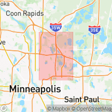
Pg. 7 (table 2), 23-24. Fridley Formation. Has 2 lithofacies almost identical to corresponding facies in New Brighton Formation: light-gray to very pale brown fine to medium sand and gray silty clay. Mostly deposited in a lake. Upper 5 to 15 feet have been substantially modified by wind action and soil-forming processes. Unit includes sand dunes at surface. Occurs above New Brighton Formation and below West Campus Sand. Recognized in southeastern Minnesota. Age is Pleistocene.
Type section (sand facies): drainage ditch at intersection of US Hwy 8 and Hillview Road in Mounds View, NE/4 SE/4 SE/4 sec. 5, T. 30 N., R. 23 W., New Brighton quadrangle, southeastern MN; alternate type section: water well for Spring Lake Park, NE/4 NW/4 NE/4 sec. 1, T. 30 N., R. 23 W. Type section (silt facies): municipal well no. 3, Fridley, SW/4 SW/4 SE/4 sec. 14, T. 30 N., R. 24 W.; alternate type section: water well for Spring Lake Park. Named for Fridley.
Source: US geologic names lexicon (USGS Bull. 1350, p. 277).
For more information, please contact Nancy Stamm, Geologic Names Committee Secretary.
Asterisk (*) indicates published by U.S. Geological Survey authors.
"No current usage" (†) implies that a name has been abandoned or has fallen into disuse. Former usage and, if known, replacement name given in parentheses ( ).
Slash (/) indicates name conflicts with nomenclatural guidelines (CSN, 1933; ACSN, 1961, 1970; NACSN, 1983, 2005, 2021). May be explained within brackets ([ ]).