The National Geologic Map Database is migrating to a new infrastructure. We apologize for any service disruptions during this process.
|
|---|


- Usage in publication:
-
- Fresno Formation
- Modifications:
-
- First used
- AAPG geologic province:
-
- Permian basin
Summary:
Pg. 17 (table 6), 26, road logs. Fresno Formation of Bofecillos Group. Bofecillos Group comprises (ascending) Chisos Formation, Mitchell Mesa Tuff, Fresno Formation, Santana Tuff (new) and Rawls Basalt. Fresno is correlative with Tascotal Formation of Goldich and Seward (1948). In Three-dike Hill, underlies Rawls Formation. Age is Oligocene or younger.
Source: US geologic names lexicon (USGS Bull. 1350, p. 276).
- Usage in publication:
-
- Fresno Formation
- Modifications:
-
- Named
- Dominant lithology:
-
- Conglomerate
- Sandstone
- Tuff
- Trachyandesite
- Basalt
- AAPG geologic province:
-
- Permian basin
Summary:
Fresno Formation of Bofecillos Group. Succession of interbedded conglomerate, sandstone, tuff, and flow rock between Mitchell Mesa Tuff and Rawls Formation in southeastern Presidio area is mapped as Fresno Formation (Dietrich and Maxwell ms.). Flows predominate near center of Bofecillos Mountains; flow rock is rare in outcrops near Torneros Creek and west of mountains. Flow rock separately mapped as three informal members: porphyritic trachyandesite, trachyandesite, and basalt. Other rock of formation mapped and described as sedimentary rock. Only upper 200 to 250 feet and lower 150 to 200 feet of formation are exposed. Total thickness of formation in Presidio area, based on these outcrops and more complete exposures southeast of Redford, probably is between 500 to 700 feet. Age is Oligocene or younger.
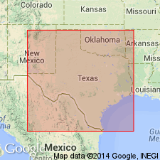
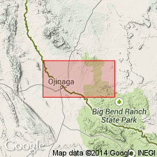
Type locality: in Fresno Canyon, 7 mi north of Fresno Creek bridge, Presidio Co., southwestern TX.
Source: US geologic names lexicon (USGS Bull. 1350, p. 276).
For more information, please contact Nancy Stamm, Geologic Names Committee Secretary.
Asterisk (*) indicates published by U.S. Geological Survey authors.
"No current usage" (†) implies that a name has been abandoned or has fallen into disuse. Former usage and, if known, replacement name given in parentheses ( ).
Slash (/) indicates name conflicts with nomenclatural guidelines (CSN, 1933; ACSN, 1961, 1970; NACSN, 1983, 2005, 2021). May be explained within brackets ([ ]).