- Usage in publication:
-
- Freeman Peak Formation
- Modifications:
-
- Named
- Dominant lithology:
-
- Quartzite
- AAPG geologic province:
-
- Wasatch uplift
Summary:
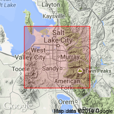
Is 1 of 5 units in the Bingham sequence. Named for Freeman Peak in sec 16, T3S, R3W, Salt Lake Co, UT on the Wasatch uplift. Name replaces Clinker Formation. Consists of thick-bedded, light gray to tan calcareous quartzite and orthoquartzite. Some interbedded thin calcareous sandstone, platy argillaceous siltstone and shale. Is 2,400 ft thick. Fusulinids are abundant locally. Overlies Curry Peak Formation (formerly Curry Formation). Underlies "Kirkman-Diamond Creek Formation." No type locality designated. Occurs (geologic map) from Lead Mine in Bingham Canyon, north and west to upper Dry Fork, and Freeman Peak, and across west face of mouth of Leavetts and Pass Canyons in north-central part of mapped area. Of Early Permian age. Graphic section.
Source: GNU records (USGS DDS-6; Denver GNULEX).
For more information, please contact Nancy Stamm, Geologic Names Committee Secretary.
Asterisk (*) indicates published by U.S. Geological Survey authors.
"No current usage" (†) implies that a name has been abandoned or has fallen into disuse. Former usage and, if known, replacement name given in parentheses ( ).
Slash (/) indicates name conflicts with nomenclatural guidelines (CSN, 1933; ACSN, 1961, 1970; NACSN, 1983, 2005, 2021). May be explained within brackets ([ ]).

