

- Usage in publication:
-
- Franks conglomerate*
- Modifications:
-
- First used
- Dominant lithology:
-
- Conglomerate
- Shale
- Limestone
- Sandstone
- AAPG geologic province:
-
- Arkoma basin
- South Oklahoma folded belt
Summary:
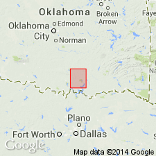
First published use in Tishomingo quad, Johnston Co, OK in South Oklahoma folded belt. Intent to name not stated, and no type locality designated. Probably named from town of Franks, Pontotoc Co, OK in Arkoma basin. Extends in a broad belt across the northwestern part of Arbuckle region and into northwestern part of Tishomingo quad. Lies unconformably on eroded edges of Ordovician, Silurian (Hunton, new), Devonian (Woodford, new), and Mississippian (Caney) formations. Is a coarse limestone and chert conglomerate interbedded with sandstone, shale, and fossiliferous, thin-bedded limestone. Occurs above Glenn formation (first used). Thickness is 200-500 ft. Age is Late Carboniferous (Pennsylvanian). Occupies a position in the section approximately the same as the Wapanucka limestone. Geologic map. Columnar section.
Source: GNU records (USGS DDS-6; Denver GNULEX).
- Usage in publication:
-
- Franks conglomerate
- Modifications:
-
- Revised
- AAPG geologic province:
-
- Arkoma basin
Summary:
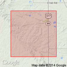
Franks conglomerate found by this author to represent the shoreward phase of the McAlester, Savanna, Boggy, and possibly younger formations; it is not equivalent to Wapanucka limestone. Report area is Stonewall quad, Pontotoc Co, OK in Arkoma basin. Therefore, term Franks conglomerate should be either: 1) abandoned and the strata comprising it be divided as nearly as possible into the formations which they represent; or 2) used only in a restricted sense to apply to Pennsylvanian strata in type area around town of Franks (T2N, R6E, Pontotoc Co, OK) and to those exposures of Pennsylvanian limestone conglomerates in the Arbuckle area which, in common with the strata at Franks, are found to be fossiliferous, highly faulted or folded, and nonarkosic. The first suggestion is more logical, and would end confusion regarding Franks; however, the second suggestion preserves long use of the term Franks. It is a more general term, and is, therefore, more easily applied. For these reasons, it is probably desirable to preserve the term Franks--but if it is preserved, it must be limited as here indicated. Diagram shows different usages of Franks from 1903 to 1923.
Source: GNU records (USGS DDS-6; Denver GNULEX).
For more information, please contact Nancy Stamm, Geologic Names Committee Secretary.
Asterisk (*) indicates published by U.S. Geological Survey authors.
"No current usage" (†) implies that a name has been abandoned or has fallen into disuse. Former usage and, if known, replacement name given in parentheses ( ).
Slash (/) indicates name conflicts with nomenclatural guidelines (CSN, 1933; ACSN, 1961, 1970; NACSN, 1983, 2005, 2021). May be explained within brackets ([ ]).