The National Geologic Map Database is migrating to a new infrastructure. We apologize for any service disruptions during this process.
|
|---|


- Usage in publication:
-
- Fraction dacite breccia*
- Modifications:
-
- First used
- Dominant lithology:
-
- Dacite
- AAPG geologic province:
-
- Great Basin province
Summary:
First published use of name for brown or green, soft and friable, volcanic rocks. Intent to name, source of geographic name, and type locality not stated. Varies in thickness; is several hundred ft thick at most localities; is 745 ft thick in the New York Tonopah shaft. Mapped (geologic map) in central and southern parts of the Tonopah mining district in Esmeralda and Nye Cos, NV in the Great Basin province. Younger than Heller dacite (first used). Is older than Tonopah rhyolite-dacite (first used). Most of its contacts are faults. Consists of broken, close-packed, medium-size fragments of pumiceous dacite. These rocks were probably partly or entirely volcanic mudflows in which highly pumiceous and aqueous lava mixed with heated water, and was partly broken and ground up by flowing. Has some rude stratification. Upper part is more fragmental than lower part at the New York Tonopah shaft. Microscopically, Fraction is a biotite dacite. Porphyritic crystals are usually broken quartz, sparse biotite, and feldspar. Groundmass is brown glass, often felty, frequently vesicular. Tertiary age.
Source: GNU records (USGS DDS-6; Denver GNULEX).
- Usage in publication:
-
- Fraction rhyolite breccia*
- Modifications:
-
- Redescribed
- Revised
- Areal extent
- AAPG geologic province:
-
- Great Basin province
Summary:
Rhyolite breccia predominates in Fraction throughout Divide district; rock is therefore renamed Fraction rhyolite breccia. Shown on geologic sketch map as part of Siebert formation which is probably late Miocene in age. Thickness is over 600 ft. Consists of intercalated beds of soft fine-grained tuff which range in thickness from a few inches to 200 ft; tuffs correspond in composition to Spurr's (1905) Siebert tuff in Tonopah district.
Source: GNU records (USGS DDS-6; Menlo GNULEX).
- Usage in publication:
-
- Fraction breccia*
- Modifications:
-
- Revised
- AAPG geologic province:
-
- Great Basin province
Summary:
"Siebert" formation is abandoned in broad sense for name Esmeralda formation, so Fraction rhyolite breccia becomes member of Esmeralda formation. Round Rock member of Esmeralda formation in Manhattan district "is believed to be equivalent to Fraction breccia of Tonopah."
Source: GNU records (USGS DDS-6; Menlo GNULEX).
- Usage in publication:
-
- Fraction breccia*
- Modifications:
-
- Redescribed
- AAPG geologic province:
-
- Great Basin province
Summary:
Proposes "Fraction breccia" for Spurr's (1905) Fraction dacite breccia and Knopf's (1921) Fraction rhyolite breccia because at Tonopah basal portion of unit contains very large amounts of andesitic-appearing debris, with result that there has at times been considerable confusion as to proper correlation of beds. All examples of "Midway andesite" cappings of veins proved to be basal portion of Fraction breccia. Unit is considered by Ferguson (1924) to be basal member of Esmeralda formation and therefore is of late Miocene age.
Source: GNU records (USGS DDS-6; Menlo GNULEX).
- Usage in publication:
-
- Fraction Breccia*
- Modifications:
-
- Revised
- AAPG geologic province:
-
- Great Basin province
Summary:
Fraction Breccia removed from Esmeralda Formation. Mapped in Esmeralda County with breccia and tuff of dominantly rhyolitic composition.
Source: GNU records (USGS DDS-6; Menlo GNULEX).
- Usage in publication:
-
- Fraction Tuff*
- Modifications:
-
- Redescribed
- Areal extent
- AAPG geologic province:
-
- Great Basin province
Summary:
Mapped in Belted Peak 15' quad, Nye Co, NV. Fraction Breccia changed to Fraction Tuff in this area. Consists of compound cooling unit, light-gray and medium-brown partly to densely welded vitric tuff. Thickness ranges to 1000 ft. Overlies rhyolite and tuff of White Ridge. Underlies Tertiary bedded tuff and sandstone and Quaternary alluvium and colluvium. Age is shown as Miocene. [no basis given]
Source: GNU records (USGS DDS-6; Menlo GNULEX).
- Usage in publication:
-
- Fraction Tuff*
- Modifications:
-
- Geochronologic dating
- AAPG geologic province:
-
- Great Basin province
Summary:
Fraction Tuff. Samples from rhyolitic welded tuff, at Heller Butte, in NE/4 sec. 2, T. 2 N., R. 42 E., Nye County, Nevada, yielded K-Ar ages of 17.1 +/-0.3 Ma (biotite) and 16.9 +/-0.3 Ma (sanidine).
Source: Modified from GNU records (USGS DDS-6; Menlo GNULEX).
- Usage in publication:
-
- Fraction Tuff
- Modifications:
-
- Areal extent
- Age modified
- AAPG geologic province:
-
- Great Basin province
Summary:
Within Tonopah mining district unit consists of six separate rhyolitic ash-flows shown separately on geologic map of district. [These flows include rocks included in purr's (1905) Tonopah Rhyolite Dacite, Heller Dacite, and Fraction Dacite Breccia.] Unconformably overlies Mizpah Trachyte; unconformably underlies Siebert Tuff. Generalized stratigraphic column shows age to be Miocene. [no basis given]
Source: GNU records (USGS DDS-6; Menlo GNULEX).
- Usage in publication:
-
- Fraction Tuff*
- Modifications:
-
- Areal extent
- AAPG geologic province:
-
- Great Basin province
Summary:
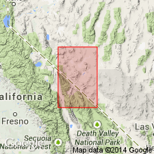
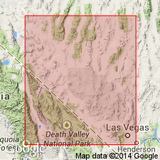
Fraction Tuff is one of three widespread stratigraphically important ash-flow tuffs that is used in preference to the name Indian Trail Formation (abandoned in this report). Fraction is a compound cooling unit of Miocene age (16-18 m.y.) that is present north of the Test Site. Distribution map of tuff on Yucca Flat, Nye Co, NV in the Great Basin province. Maximum thickness near Whiterock Spring is 115 m. Maximum thickness in subsurface southwest of Rainier Mesa is 351 m.
Source: GNU records (USGS DDS-6; Denver GNULEX).
- Usage in publication:
-
- Fraction Tuff*
- Modifications:
-
- Age modified
- AAPG geologic province:
-
- Great Basin province
Summary:
Nevada Fraction Tuff adopted as used by Bonham and Garside(1974) in Tonopah area, in that it includes six informally designated ash flows, rocks formerly included by Spurr (1905) in his Tonopah Rhyolite Dacite, Heller Dacite, and Fraction Dacite Breccia. As so defined unconformably overlies Mizpah Trachyte; unconformably underlies Siebert Tuff. Name restricted from Manhattan mining district [see Ferguson, 1924]. Age is Miocene on basis of 17.1 to 16.9 +/-0.3 Ma (Silberman and McKee, 1972) on sample collected at Heller Butte.
Source: GNU records (USGS DDS-6; Menlo GNULEX).
For more information, please contact Nancy Stamm, Geologic Names Committee Secretary.
Asterisk (*) indicates published by U.S. Geological Survey authors.
"No current usage" (†) implies that a name has been abandoned or has fallen into disuse. Former usage and, if known, replacement name given in parentheses ( ).
Slash (/) indicates name conflicts with nomenclatural guidelines (CSN, 1933; ACSN, 1961, 1970; NACSN, 1983, 2005, 2021). May be explained within brackets ([ ]).