

- Usage in publication:
-
- Fourmile sandstone
- Modifications:
-
- Original reference
- Dominant lithology:
-
- Sandstone
- Shale
- AAPG geologic province:
-
- Chautauqua platform
Summary:
[Published separately in 1918.] Pg. 17-20. Fourmile sandstone. Massive sandstone, about 25 feet thick, overlain and underlain by some thinner sandstones and interbedded red shales, the whole having a thickness of about 40 feet, but this varies considerably from place to place. The basal bed is distinguished from other sandstones in this part of section by being coarse and gritty, but not conglomeratic. Rests on a gray shale. A thin limestone lies 10 to 15 feet below base of Fourmile sandstone. The Fourmile sandstone lies 40+/- feet below top of section in T. 24 N., R. 10 E., and 250+/- feet above Birch Creek limestone. Age is Late Pennsylvanian.
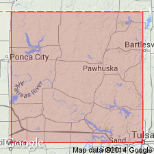
Named from exposures on the point south of Fourmile Creek, in SW/4 sec. 30, T. 24 N., R. 10 E., Osage Co., central northern OK.
[Fourmile sandstone member of Nelagoney formation adopted (ca. 1936) by the USGS for use in its publications.]
Source: US geologic names lexicon (USGS Bull. 896, p. 765).

- Usage in publication:
-
- Fourmile Sandstone Member†
- Modifications:
-
- Abandoned
- AAPG geologic province:
-
- Chautauqua platform
Summary:
†Fourmile Sandstone Member of †Nelagoney Formation. The USGS has abandoned both the Nelagoney Formation and the Fourmile Sandstone. The Fourmile is equal to Cochahee Sandstone Member of Vamoosa Formation.
Source: US geologic names lexicon (USGS Bull. 1200, p. 1408).
For more information, please contact Nancy Stamm, Geologic Names Committee Secretary.
Asterisk (*) indicates published by U.S. Geological Survey authors.
"No current usage" (†) implies that a name has been abandoned or has fallen into disuse. Former usage and, if known, replacement name given in parentheses ( ).
Slash (/) indicates name conflicts with nomenclatural guidelines (CSN, 1933; ACSN, 1961, 1970; NACSN, 1983, 2005, 2021). May be explained within brackets ([ ]).