- Usage in publication:
-
- Fourmile Draw Member
- Modifications:
-
- Original reference
- Dominant lithology:
-
- Dolomite
- Gypsum
- Mudstone
- Sandstone
- Siltstone
- AAPG geologic province:
-
- Orogrande basin
- Permian basin
Summary:
Pg. 6 (Table 1), 11 (Fig. 4), 13-14, pl. 4. Fourmile Draw Member of San Andres Formation. Thin-bedded gypsum and dolomite, with reddish mudstone; locally includes red siltstone and at top, a clean white sandstone interval 20 to 30 feet thick. In places, greatly pockmarked by small sink holes. Thickness 384 feet at type locality; ranges 0 to 700 feet (0 to 210 m). Top member of San Andres Formation. Overlies Bonney Canyon Member of San Andres Formation; underlies Grayburg Formation of Artesia Group. Age is Early Permian (Leonardian).
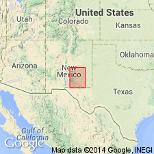
Type locality: Fourmile Draw, in T. 18 S., R. 19 through 21 E., [approx. Lat. 42 deg. 30 min. N., and btw. Long. 104 deg. 45 min. and Long. 105 deg. 00 min., Holt Tank and Encino Draw 7.5-min quadrangles, Chaves and Eddy Cos.], southeastern NM. Named from Fourmile Draw.
Source: Publication; US geologic names lexicon (USGS Bull. 1520, p. 107-108).
For more information, please contact Nancy Stamm, Geologic Names Committee Secretary.
Asterisk (*) indicates published by U.S. Geological Survey authors.
"No current usage" (†) implies that a name has been abandoned or has fallen into disuse. Former usage and, if known, replacement name given in parentheses ( ).
Slash (/) indicates name conflicts with nomenclatural guidelines (CSN, 1933; ACSN, 1961, 1970; NACSN, 1983, 2005, 2021). May be explained within brackets ([ ]).

