- Usage in publication:
-
- Forty-niner member*
- Modifications:
-
- Named
- Dominant lithology:
-
- Siltstone
- Gypsum
- AAPG geologic province:
-
- Permian basin
Summary:
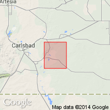
Named as the upper member ( of 5) of Rustler formation for Forty-niner Ridge, T 22 N, R 30 E, on east side of Nash Draw, Eddy Co., NM in the Permian basin. No type locality designated. Is exposed on a minor bluff below Livingston Ridge. Mapped (geologic map) at several localities in the central-west and southwest part of quad (1:62,000). Overlies Magenta member of Rustler. Is overlain by the Pierce Canyon redbeds; this contact is obscured by swelling and deformation of the top bed, a gypsum about 35 ft thick. Consists, on outcrop of massive siltstone 5 to 10 ft thick that is overlain by massive, coarsely crystalline, white-gray gypsum 35 ft thick. The siltstone is moderate reddish-orange with light-gray circular spots 1 to 5 mm in diameter, friable; it weathers more easily than either the overlying or underlying units. Anhydrite replaces gypsum in the subsurface. Cuttings from two wells described. Assigned a Late Permian age. Stratigraphic table. Well cuttings described.
Source: GNU records (USGS DDS-6; Denver GNULEX).
For more information, please contact Nancy Stamm, Geologic Names Committee Secretary.
Asterisk (*) indicates published by U.S. Geological Survey authors.
"No current usage" (†) implies that a name has been abandoned or has fallen into disuse. Former usage and, if known, replacement name given in parentheses ( ).
Slash (/) indicates name conflicts with nomenclatural guidelines (CSN, 1933; ACSN, 1961, 1970; NACSN, 1983, 2005, 2021). May be explained within brackets ([ ]).

