


- Usage in publication:
-
- Fortune formation
- Modifications:
-
- Original reference
- AAPG geologic province:
-
- Ozark uplift
Summary:
Pg. 9-15. Fortune formation. Name applied to the sequence of sandstone, chert, and limestone which intervenes between Cotter dolomite below and Sylamore sandstone above. Thickness at type section 6 feet. Locally, the Compton or Chattanooga may lie on the Fortune. Age is Devonian.
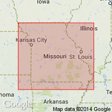
Type section: in NE/4 SW/4 SW/4 sec. 4, T. 23 N., R. 26 W., Barry Co., southwestern MO. Named from Fortune Branch. Formation restricted in its outcrops to eastern one-fourth of Cassville quadrangle and western one-fourth of Shell Knob quadrangle, an area of approx. 100 sq mi.
Source: US geologic names lexicon (USGS Bull. 1200, p. 1403).
- Usage in publication:
-
- Fortune Formation
- Modifications:
-
- Overview
- AAPG geologic province:
-
- Ozark uplift
Summary:
Pg. 108. Fortune Formation. Predominantly chert, usually highly brecciated, with a few localities containing a very black recrystallized limestone associated with the chert (Thompson and Satterfield, 1975, Missouri Geol. Survey Rpt. Inv., no. 57, pt. 4, p. 121-140). It occurs in a small area in Barry County, southwestern Missouri, and appears to be a remnant of thicker Middle Devonian strata still present to the south in northwestern Arkansas. Age is Middle Devonian.
See also T.L. Thompson, 1993, Missouri Div. Geol. and Land Survey Rpt. Inv., no. 70, pt. 3, 228 p.; 1995, Missouri Div. Geol. and Land Survey, Vol. 40 (2nd ser.) revised, 189 p.
Type section forms a small bench in the private road or trail about 20 ft above the bottom of Fortune Branch. Named from Fortune Branch located in SE/4 sec. 4, T. 23 N., R. 26 W., Barry Co., MO, about 9 miles northeast of Cassville (citing Grohskopf and others, 1943, p. 10).
Source: Publication.
For more information, please contact Nancy Stamm, Geologic Names Committee Secretary.
Asterisk (*) indicates published by U.S. Geological Survey authors.
"No current usage" (†) implies that a name has been abandoned or has fallen into disuse. Former usage and, if known, replacement name given in parentheses ( ).
Slash (/) indicates name conflicts with nomenclatural guidelines (CSN, 1933; ACSN, 1961, 1970; NACSN, 1983, 2005, 2021). May be explained within brackets ([ ]).