

- Usage in publication:
-
- Fort Terrett Formation
- Modifications:
-
- Original reference
- Dominant lithology:
-
- Dolomite
- AAPG geologic province:
-
- Permian basin
Summary:
Pg. 30-32. Fort Terrett Formation of Edwards Group. Chiefly dolomite and evaporite. Thickness 49 m at type locality. Includes Kirschberg Evaporite Member. Overlies Hensell Formation; underlies Segovia Formation of Edwards Group or Fort Lancaster Formation of Washita Group. Age is Early Cretaceous (Comanchean).
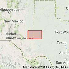
Type locality: roadcuts of U.S. Highway 290 where highway rises out of valley of North Llano River, onto Edwards Plateau, 0.8 km south of Roosevelt, Kimble Co., central TX. Named from Fort Terrett, a 19th century army post, 13 km to the west.
Source: US geologic names lexicon (USGS Bull. 1520, p. 107).
- Usage in publication:
-
- Fort Terrett Formation
- Modifications:
-
- Mapped 1:250k
- Dominant lithology:
-
- Limestone
- Shale
- AAPG geologic province:
-
- Permian basin
Summary:
Pamphlet [p. 3]. Fort Terrett Formation [of Edwards Group]. Limestone and shale. Limestone, nodular, grayish yellow, light-gray. Shale, calcareous, thinly laminated, dusky yellow, yellowish gray, light olive-gray, dark gray. Marine megafossils abundant in some beds. Outcrop thickness of 53 feet measured at northwestern margin of McKenzie Lake. Correlative with Fredericksburg Group, undivided. Lies below Ogallala Formation (Pliocene) and above Antlers Sand (Lower Cretaceous). Age is Early Cretaceous.
[Small isolated exposures mapped in: oil fields of southeastern Andrews Co.; McKenzie Lake, southeastern Gaines Co.; along eastern edge of map sheet in Martin Co., TX; and Eunice area, eastern Lea Co., NM.]
Source: Publication.

- Usage in publication:
-
- Fort Terrett Member
- Modifications:
-
- Revised
- Mapped 1:250k
- Dominant lithology:
-
- Limestone
- Dolomite
- AAPG geologic province:
-
- Kerr basin
- Permian basin
Summary:
Fort Terrett Member of Edwards Limestone. Limestone and dolomite; upper quarter, porcelaneous aphanitic limestone, collapse breccia, chert, and recrystallized limestone; in middle, light- to dark-gray, cherty dolomite, miliolid, shell fragment, rudistid limestone, and medium brownish-gray dolomite; in lower quarter, nodular limestone, with thin, yellow, EXOGYRA TEXANA-bearing clay at base. Thickness 230 to 300 feet, thickens southward. Lies below Segovia Member of Edwards Limestone and above Glen Rose Limestone. Correlative with Del Carmen Limestone, West Nueces Formation, and lower parts of Sue Peaks and McKnight Formations. Age is Early Cretaceous.
Mapped in Edwards and Real Cos., southern TX.
[Also mapped and similarly described in: San Antonio sheet (revised 1982) to east, in Bandera, Kerr, and Real Cos., thickness 230 to 300 feet; Llano sheet to northeast, in Edwards, Gillespie, Kendall, Kerr, Kimble, Mason, and Menard Cos., thickness 150 to 230 feet; Sonora sheet to north, along river and creek valleys, thickness about 150 to 300 feet; and Fort Stockton sheet (revised 1994) to northwest, in Brewster, Pecos, and Terrell Cos., thickness 150 to 250 feet.]
Source: Publication.
For more information, please contact Nancy Stamm, Geologic Names Committee Secretary.
Asterisk (*) indicates published by U.S. Geological Survey authors.
"No current usage" (†) implies that a name has been abandoned or has fallen into disuse. Former usage and, if known, replacement name given in parentheses ( ).
Slash (/) indicates name conflicts with nomenclatural guidelines (CSN, 1933; ACSN, 1961, 1970; NACSN, 1983, 2005, 2021). May be explained within brackets ([ ]).