- Usage in publication:
-
- Fort Lowell Formation*
- Modifications:
-
- Named
- Dominant lithology:
-
- Sand
- Gravel
- AAPG geologic province:
-
- Basin-and-Range province
Summary:
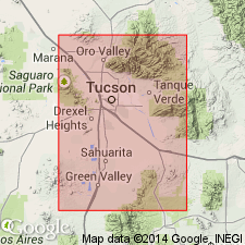
Named for the abandoned Fort Lowell near intersection of Pantano Wash and Tanque Verde Creek, Pima Co, AZ in the Basin-and-Range province. Type section is a well in NE1/4 NW1/4 SE1/4 sec 31, T13S, R14E where formation unconformably overlies the informal Pliocene Tinaja beds (first used) and unconformably underlies upper Pleistocene surficial deposits. Consists of flat-lying, red-brown, brown-gray, and gray-brown, silty, pebbly, medium- to coarse-grained, loosely packed to weakly cemented sand 235 ft thick overlain by 60 ft of red-brown, sandy pebble gravel at type. Sand has many clasts of banded gray and white Catalina Gneiss and traces of light-colored felsitic volcanic rocks and red-brown stained granitic gneiss clasts in some of the beds. Is a locally derived fan deposit that was laid down by streams in a closed basin. Underlies most of the Tucson basin. Is known mainly from drill cuttings and cores. May be as much as 400 ft thick; thins towards the mountains. Lower contact difficult to pick in subsurface. Changes from silty gravel near margin of basin to silty sand and clayey silt in central part of basin. Assigned to the Pleistocene [reason not stated]. Geologic map.
Source: GNU records (USGS DDS-6; Denver GNULEX).
For more information, please contact Nancy Stamm, Geologic Names Committee Secretary.
Asterisk (*) indicates published by U.S. Geological Survey authors.
"No current usage" (†) implies that a name has been abandoned or has fallen into disuse. Former usage and, if known, replacement name given in parentheses ( ).
Slash (/) indicates name conflicts with nomenclatural guidelines (CSN, 1933; ACSN, 1961, 1970; NACSN, 1983, 2005, 2021). May be explained within brackets ([ ]).

