- Usage in publication:
-
- Fort Johnson member
- Modifications:
-
- Original reference
- Dominant lithology:
-
- Dolomite
- AAPG geologic province:
-
- Appalachian basin
Summary:
Pg. 76 (fig. 2), 84-85. Fort Johnson member of Tribes Hill formation. Name proposed for basal member of formation in Mohawk Valley. Breccia of dolomite cobbles or a sandstone stratum commonly forms base. Lower part is predominantly dolomite (dolomisiltite and dolomarenite). Above is a transition zone of calcite dolomite and dolomitic limestone. Upper part is primarily thick-bedded white-weathering blue-black dolomitic calcilutite in which irregular buff-weathering dolomite patches stand out in relief. Thickness 28 feet at type locality where base is concealed. Thickened extension of lower half of unit reaches 90 feet in northeastern part of Amsterdam quadrangle; this interval, when traced into Saratoga Springs area, is coextensive with Gailor dolomite. Underlies Palatine Bridge member (new) and is overlapped by it northward; contact gradational west of Cranesville and unconformable to the east. Overlies an unnamed dolomite, usually conformably. Age is Early Ordovician (early Canadian).
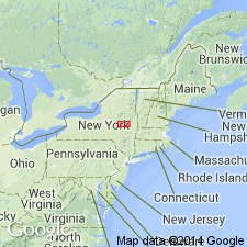
Type locality: abandoned quarry and West Shore RR cut 2 mi east of Fort Hunter, Montgomery Co., east-central NY. Named from village of Fort Johnson on north side of Mohawk River northeast of Fort Hunter.
Source: US geologic names lexicon (USGS Bull. 1200, p. 1395).
For more information, please contact Nancy Stamm, Geologic Names Committee Secretary.
Asterisk (*) indicates published by U.S. Geological Survey authors.
"No current usage" (†) implies that a name has been abandoned or has fallen into disuse. Former usage and, if known, replacement name given in parentheses ( ).
Slash (/) indicates name conflicts with nomenclatural guidelines (CSN, 1933; ACSN, 1961, 1970; NACSN, 1983, 2005, 2021). May be explained within brackets ([ ]).

