The National Geologic Map Database is migrating to a new infrastructure. We apologize for any service disruptions during this process.
|
|---|


- Usage in publication:
-
- Fort Hunter sandstone member
- Modifications:
-
- Original reference
- Dominant lithology:
-
- Sandstone
- AAPG geologic province:
-
- Appalachian basin
Summary:
Pg. 138, 139, 164, 165 (fig. 38), 180-182 (Section on Middle and Upper Devonian by Bradford Willard). Fort Hunter sandstone member of Mahantango formation. Thin, very hard dark-gray rusty-weathering of Montebello sandstone facies of the Mahantango. Occurs near base of [Skaneateles] facies of Mahantango from Perry County east of the Schuylkill River. Thickness about 5 feet. Was called Rockville by Willard and Cleaves (1938), but that name is preoccupied. Age is Middle Devonian.
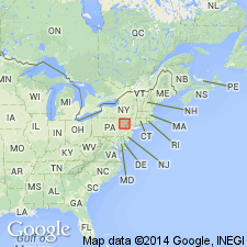
Type locality: southernmost quarry at Rockville, Dauphin Co., central PA. Named from Fort Hunter, 4 mi north of Harrisburg.
Source: US geologic names lexicon (USGS Bull. 1200, p. 1395).
For more information, please contact Nancy Stamm, Geologic Names Committee Secretary.
Asterisk (*) indicates published by U.S. Geological Survey authors.
"No current usage" (†) implies that a name has been abandoned or has fallen into disuse. Former usage and, if known, replacement name given in parentheses ( ).
Slash (/) indicates name conflicts with nomenclatural guidelines (CSN, 1933; ACSN, 1961, 1970; NACSN, 1983, 2005, 2021). May be explained within brackets ([ ]).