


- Usage in publication:
-
- Fort Hall formation*
- Modifications:
-
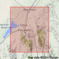
- Areal extent
- AAPG geologic province:
-
- Snake River basin
Summary:
Pg. 492. Fort Hall formation of Thaynes group. Middle formation of Thaynes group in Fort Hall Indian Reservation, southeastern Idaho. Thickness 600 feet. Underlies Portneuf limestone and overlies Ross limestone. [Age is Early Triassic.]
Source: US geologic names lexicon (USGS Bull. 896, p. 755-756).
- Usage in publication:
-
- Fort Hall formation*
- Modifications:
-
- Principal reference
- Biostratigraphic dating
- Dominant lithology:
-
- Sandstone
- Limestone
- AAPG geologic province:
-
- Snake River basin
Summary:
Pg. 32, 37. Fort Hall formation of Thaynes group. In descending order: (1) yellow to grayish cherty and sandy limestones in thin beds, 600+/- feet; (2) at two localities only a set of sandy and shaly gray limestones 50+/- feet thick including an oolitic bed 6 to 10 feet thick; (3) gray or yellowish siliceous dense limestone containing large pectinoids and irregular cherty nodules and streaks that weather with rough surface and project along bedding planes, 100+/- feet; (4) soft and somewhat sugary yellow calcareous sandstone, 50+/- feet. [Fossils listed, identified by G.H. Girty, USGS, see p. 38.] Fort Hall might appropriately be called AVICULIPECTEN [AVICULOPECTEN] IDAHOENSIS zone, for it is characterized by that species. Is middle formation of Thaynes group in Fort Hall Indian Reservation. Underlies Portneuf limestone conformably and overlies Ross [Ross Fork] limestone conformably. Named from old Fort Hall, southeastern Idaho, the site of which is in valley of Lincoln Creek, which appears on some maps as Fort Hall Creek. The formation occupies a prominent ridge along north side of valley. Age is Early Triassic.
[Fort Hall No. 2 Historic Site at confluence of Cold and Lincoln Creeks, in NE/4 sec. 24, T. 3 S., R. 36 E., Yandell Springs 15-min quadrangle, Bingham Co., southeastern ID (USGS Historical Topographic Map Collection, accessed March 23, 2016). Notable exposures in T. 4 S., R. 38 E. northern Portneuf River valley (see Mansfield, 1920, USGS Bull. 713, pl. 3 geol. map).]
Source: US geologic names lexicon (USGS Bull. 896, p. 755-756).
- Usage in publication:
-
- Fort Hall formation*
- Modifications:
-
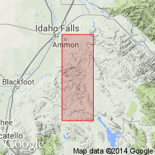
- Areal extent
- AAPG geologic province:
-
- Snake River basin
Summary:
Pg. 17, 31, pl. 1. Fort Hall formation of Thaynes group. Mapped in Ammon and Paradise Valley quadrangles where thickness is about 1,000 feet. [Age is Early Triassic.]
Source: US geologic names lexicon (USGS Bull. 1200, p. 1393-1394).
- Usage in publication:
-
- Fort Hall formation
- Modifications:
-
- Not used
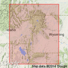
- AAPG geologic province:
-
- Central Western Overthrust
Summary:
Pg. H-172. Mansfield (Wash. Acad. Sci. Jour., v. 6, 1916) raised Thaynes to rank of group and subdivided it into (ascending) Ross Fork limestone (called Ross limestone in Mansfield's 1916 paper), Fort Hall formation, and Portneuf limestone. In area between Fort Hall Indian Reservation and Gray's Range [in Caribou County, southeastern Idaho], these three divisions of Thaynes are distinctive. Eastward toward Salt River Range and southward toward Bear Lake Valley [in Lincoln County, southwestern Wyoming], the Ross Fork and Fort Hall formations lose their identity. The Portneuf is a much more distinctive unit, and parts of it can be traced from Fort Hall, Idaho, to Cumberland, Wyoming. Name Portneuf is retained, but in present paper names Ross Fork and Fort Hall are not used.
Source: US geologic names lexicon (USGS Bull. 1200, p. 1393-1394).
- Usage in publication:
-
- Fort Hall Member*
- Modifications:
-
- Revised
- AAPG geologic province:
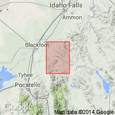
-
- Snake River basin
Summary:
Fort Hall Member of Thaynes Formation. Interbedded tan- to rusty-brown-weathering, tan, very fine grained sandstone and quartzite, brown sandy shale or mudstone, and gray limestone. Limestone near top of member thick-bedded and contains sandy streaks and layers. Pectenoid fossils locally abundant. Thickness about 2,000 feet (610 m). Lies below Portneuf Limestone Member and above Ross Fork Limestone Member; both of Thaynes Formation. Age is Early Triassic.
[See also W.C. Rember and E.H. Bennett, 1979, Idaho Geol. Survey Geol. Map, no. 12, scale 1:250,000.]
Source: Publication; GNC index card files (USGS-Reston).
For more information, please contact Nancy Stamm, Geologic Names Committee Secretary.
Asterisk (*) indicates published by U.S. Geological Survey authors.
"No current usage" (†) implies that a name has been abandoned or has fallen into disuse. Former usage and, if known, replacement name given in parentheses ( ).
Slash (/) indicates name conflicts with nomenclatural guidelines (CSN, 1933; ACSN, 1961, 1970; NACSN, 1983, 2005, 2021). May be explained within brackets ([ ]).