

- Usage in publication:
-
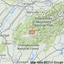
- Fort Butler Mountain
- Modifications:
-
- Overview
- AAPG geologic province:
-
- Piedmont-Blue Ridge province
Summary:
Age of the Mineral Bluff Group, which unconformably overlies the Hiwassee River Group in the Murphy belt of NC and GA, is still in question. Rocks are undated paleontologically. Correlations depend upon estimate of metamorphic age of Mineral Bluff and age of underlying Murphy Marble. Most workers have correlated the Murphy Marble with the Shady Dolomite of Early Cambrian age, which would imply that the Mineral Bluff is Early Cambrian or younger. Age estimates for the metamorphic peak range between Middle Ordovician and Carboniferous, which would allow the Mineral Bluff to range in age between Early Cambrian and Carboniferous. A correlation with the Silurian-Early Devonian Talladega Group has been suggested by Tull and Guthrie (1983; 1985) and Tull and Groszos (1988; 1990) based on similarities in stratigraphic setting, lithology, and thickness. This includes a possible Lay Dam Formation-Mission Mountain Formation correlation, Butting Ram (Cheaha) Quartzite-Fort Butler Mountain Formation correlation, and Jemison Chert-Harshaw Bottom Quartzite correlation. Correlation between the Precambrian(?) Walden Creek Group and the Mineral Bluff Group has not been ruled out as both sequences are turbidite dominated and contain an abundance of carbonate detritus, among other similarities.
Source: GNU records (USGS DDS-6; Reston GNULEX).
- Usage in publication:
-
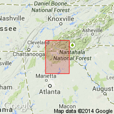
- Fort Butler Mountain Formation
- Modifications:
-
- Named
- Dominant lithology:
-
- Phyllite
- Metasandstone
- AAPG geologic province:
-
- Piedmont-Blue Ridge province
Summary:
Fort Butler Mountain Formation, here named, is second thickest unit of Mineral Bluff Group (rank raised). Measures approximately 650 m. Exposures hold up numerous mountains and ridge tops that lie east of and parallel to U.S. Hwys 64 and 19/129 between Ranger and Andrews, NC. Predominant lithology is a thinly laminated to massive graphite-bearing sericitic metapelite. Metasandstone and metaconglomerate layers are interlayered with these phyllites. Excellent exposures are found on Bell, Fort Butler, Wildcat, and Will Scott Mountains. Fort Butler Mountain overlies Mission Mountain Formation (new name) and underlies Harshaw Bottom Quartzite (new name), both of Mineral Bluff Group.
Source: GNU records (USGS DDS-6; Reston GNULEX).
For more information, please contact Nancy Stamm, Geologic Names Committee Secretary.
Asterisk (*) indicates published by U.S. Geological Survey authors.
"No current usage" (†) implies that a name has been abandoned or has fallen into disuse. Former usage and, if known, replacement name given in parentheses ( ).
Slash (/) indicates name conflicts with nomenclatural guidelines (CSN, 1933; ACSN, 1961, 1970; NACSN, 1983, 2005, 2021). May be explained within brackets ([ ]).