

- Usage in publication:
-
- Fort Apache limestone
- Modifications:
-
- Original reference
- AAPG geologic province:
-
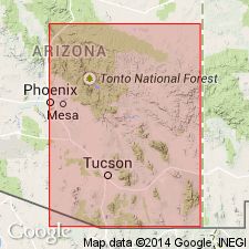
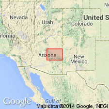
- Black Mesa basin
- Basin-and-Range province
Summary:
Pg. 533-536. Fort Apache limestone in Supai formation. In his work on geology of Arizona Darton mentions "a thick member of limestone about 100 feet below top of Supai formation" in Fort Apache Indian Reservation area, southeastern Arizona, and stated that it carries Manzano fossils. This limestone is herein described as Fort Apache limestone. It lies considerably above the Permian plant-bearing beds (pink sandstone and shale) here named Kinishba beds of Supai formation. In Plateau wall there are 400+/- feet of Supai beds above Fort Apache limestone. The Fort Apache consists of gray limestone, 70 feet thick at Kelly Butte (the top of which it forms), very fossiliferous [fossils listed], and lying 489 feet above Kinishba beds, 20 feet thick. The latter beds (which occur in basal part of Supai formation) are named for occurrence in walls of an old Indian pueblo, known as Kinishba, on bank of a dry wash southwest of White River settlement and northwest of Fort Apache, at foot of Kelly Butte. Age is Permian.
Source: US geologic names lexicon (USGS Bull. 896, p. 754).
- Usage in publication:
-
- Fort Apache limestone member
- Modifications:
-
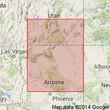
- Areal extent
- AAPG geologic province:
-
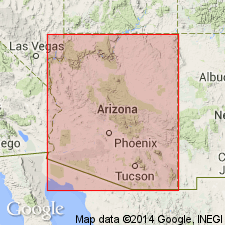
- Basin-and-Range province
- Black Mesa basin
Summary:
Pg. 86, 88, fig. 2. Fort Apache limestone member of Supai formation. Underlies Corduroy member (new); overlies "Big A" [Big A Butte] sand facies.
Source: US geologic names lexicon (USGS Bull. 1200, p. 1391).
- Usage in publication:
-
- Fort Apache Limestone Member*
- Modifications:
-
- Revised
- AAPG geologic province:
-
- Black Mesa basin
- Basin-and-Range province
Summary:
Assigned to Supai Formation as one of four members. Ranges from 10 to 95 feet thick. Forms prominent cliffs. Caps uplands and ridges. This gray thin-bedded fossiliferous limestone has a molluscan and brachiopod fauna. Its fauna may be compared to those of the alpha Member of the Kaibab Limestone, the Manzano fauna, and the Colina fauna. Age is Early Permian (early Leonardian). Has some very fine particles of quartz that have been interpreted as (1) reworked residual material concentrated during interruptions of limestone deposition, or (2) as terrigenous material deposited when limestone not forming. Fossils in Apache appear not to have been transported. Described from 10 measured sections in Navajo County, Arizona (Black Mesa basin) and in Gila County, Arizona (Basin-and-Range province). Overlies Big A Butte Member (new) of Supai. Underlies Corduroy Member (new) of Supai.
Source: GNU records (USGS DDS-6; Denver GNULEX).
- Usage in publication:
-
- Fort Apache Member*
- Modifications:
-
- Areal extent
- Reference
- Dominant lithology:
-
- Limestone
- AAPG geologic province:
-
- Black Mesa basin
- Basin-and-Range province
Summary:
Adopted by the USGS as a member of Supai Formation. Is a cliff-forming, dark- to light-gray, silty, partly dolomitic limestone 90 to 105 feet thick. Siltstone partings between beds. Silicified pelecypods, cephalopods, and brachiopods locally abundant. Lower contact placed at base of cliff-forming limestone (of Fort Apache Member) with yellowish-gray to pale-purplish-red siltstone (of the sandstone and siltstone member). Upper contact placed at top of a light-gray to yellow-gray silty limestone (of Fort Apache Member) with tan sandstone and red siltstone (of the limestone and siltstone member). Mapped along Carrizo Creek and in southwest part of quadrangle, Navajo County, Arizona, Black Mesa basin; an areal extension. Age is Early Permian (Leonardian), based on molluscan assemblage.
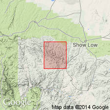
Section described by Stoyanow (1936) is incomplete. Reference section designated on Cibecue Ridge, in SE/4 sec. 20, T. 7 N., R. 19 E., Gila Co., AZ, Basin-and-Range province.
Source: Modified from GNU records (USGS DDS-6; Denver GNULEX).
- Usage in publication:
-
- Fort Apache Member
- Modifications:
-
- Redescribed
- Areal extent
- Dominant lithology:
-
- Limestone
- Dolomite
- Evaporite
- AAPG geologic province:
-
- Plateau sedimentary province
- Basin-and-Range province
Summary:
Is one of 4 (or of 5, depending on location) members of Supai Formation. Redescribed as Fort Apache Member, rather than Fort Apache Limestone Member, because it consists of limestone and dolomite. In fact dolomite is the predominant lithology throughout more than half of its areal extent. In southern exposures, is a dark-gray to black, finely crystalline fossiliferous limestone (base) and a gray, finely crystalline silty unfossiliferous dolomite (top) facies that grade north into a dark-gray, dense, finely crystalline dolomite with a minor amount of dolomitic silty limestone. An evaporite-dolomite facies occurs in the subsurface. Thickens southeastward from Flagstaff and Sedona, Coconino County (Plateau sedimentary province), and from Camp Verde, Yavapai County (Basin-and-Range province), nearly to 140 feet south of Springerville and McNary, Navajo County (Black Mesa basin). Limestone facies has molluscan-echinoderm fauna (gastropods, pelecypods, scaphopods, echinoids), and brachiopods, bryozoan, and coral fragments. Dolomite facies has only molluscan fauna. Overlies Big A Sandstone [Member] or Big A Butte [Member] of Supai. Underlies Corduroy Sandstone [Member] of Supai. Age is Early Permian (Leonardian). Report includes correlation chart, lithofacies map, isopach map.
Source: Modified from GNU records (USGS DDS-6; Denver GNULEX).
- Usage in publication:
-
- Fort Apache Member
- Modifications:
-
- Revised
- AAPG geologic province:
-
- Black Mesa basin
- Basin-and-Range province
Summary:
Fort Apache removed from Supai Formation and assigned to Schnebly Hill Formation of Sedona Group (first used) as 1 of 6 members. Name changed from Fort Apache Limestone Member to Fort Apache Member. Recognized in the eastern Mogollon Rim and in subsurface of the Mogollon slope of central Arizona, Black Mesa basin and Basin-and-Range province. Overlies Big A Butte Member of Schnebly Hill. Underlies Sycamore Pass Member of Supai. Age is Early Permian (Leonardian). Report includes block diagram, correlation chart.
Source: GNU records (USGS DDS-6; Denver GNULEX).
- Usage in publication:
-
- Fort Apache Member
- Modifications:
-
- Revised
- AAPG geologic province:
-
- Basin-and-Range province
- Plateau sedimentary province
Summary:
In central Arizona, Basin-and-Range province, Fort Apache removed from Supai Formation and assigned to Schnebly Hill Formation as its middle member [also reassigned in 1980]. Extends into the Plateau sedimentary province. In western sections, may overlie the Bell Rock Member (new); in eastern sections, overlies Big A Butte Member (revised). Both Bell Rock and the Big A Butte are basal members of the Schnebly Hill. Intertongues with and underlies the Sycamore Pass Member (new) of Schnebly Hill in western sections; underlies Corduroy Member (revised) of the Schnebly Hill. Consists of limestone, dolomite, limey siltstone, and, in the subsurface, evaporite. Pinches out at Boynton Canyon near Sedona. Can be more than 100 feet thick. Forms prominent cliff or part of a cliff throughout its extent. Is easily mappable. Age is Early Permian (Leonardian). Report includes cross sections, nomenclature chart.
Source: Modified from GNU records (USGS DDS-6; Denver GNULEX).
For more information, please contact Nancy Stamm, Geologic Names Committee Secretary.
Asterisk (*) indicates published by U.S. Geological Survey authors.
"No current usage" (†) implies that a name has been abandoned or has fallen into disuse. Former usage and, if known, replacement name given in parentheses ( ).
Slash (/) indicates name conflicts with nomenclatural guidelines (CSN, 1933; ACSN, 1961, 1970; NACSN, 1983, 2005, 2021). May be explained within brackets ([ ]).