

- Usage in publication:
-
- Fort Adams member*
- Modifications:
-
- Named
- Dominant lithology:
-
- Clay
- Claystone
- Sand
- AAPG geologic province:
-
- Mid-Gulf Coast basin
Summary:
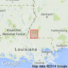
Fort Adams member of Pascagoula formation here described in Wilkinson Co., MS, as calcareous green clay, indurated blue claystone, compact sand, and light coarse sand. Thickness ranges from 135 to 235 ft based on test well data. Overlies Homochitto member (new) of Pascagoula formation. Is top of section. Can be traced from its type locality northeastward across Wilkinson Co., into Franklin Co. Age is Miocene. [This may or may not be unit referred to as Fort Adams or Ellisville phase of Grand Gulf Group.]
Source: GNU records (USGS DDS-6; Reston GNULEX).
For more information, please contact Nancy Stamm, Geologic Names Committee Secretary.
Asterisk (*) indicates published by U.S. Geological Survey authors.
"No current usage" (†) implies that a name has been abandoned or has fallen into disuse. Former usage and, if known, replacement name given in parentheses ( ).
Slash (/) indicates name conflicts with nomenclatural guidelines (CSN, 1933; ACSN, 1961, 1970; NACSN, 1983, 2005, 2021). May be explained within brackets ([ ]).