

- Usage in publication:
-
- Forest Hill sand*
- Modifications:
-
- Named
- Dominant lithology:
-
- Sand
- AAPG geologic province:
-
- Mid-Gulf Coast basin
Summary:
Pg. 187, 191-193. Forest Hill sand of Vicksburg group. Introduced to replace preoccupied name "Madison sands" of Lowe. In type area consists chiefly of cross-bedded or laminated, more or less ferruginous, siliceous sand and some clay. West of type area, the formation becomes more argillaceous and contains lenses of lignite and lignitic clay. Thickness 50 to 70 feet. A shallow water or nonmarine deposit. Basal formation of Vicksburg group in western Mississippi. Appears to rest conformably on Yazoo clay member of Jackson formation. Overlain conformably by Mint Spring calcareous marl member of Marianna limestone. Believed to be contemporaneous with marine Red Bluff clay. Age is early Oligocene.
Named from Forest Hill, 5.5 mi southwest of Jackson, southern MS.
[GNC remark (ca. 1936, US geologic names lexicon, USGS Bull. 896, p. 753): Some geologists and paleontologists have included Forest Hill sand in upper Eocene Jackson formation, but according to studies of C.W. Cooke it is of Oligocene age and more properly belongs to Vicksburg group, being of different lithology from Jackson. (See also Red Bluff clay.) Cooke says (AAPG Bull, vol. 19, no 8, 1935) its Vicksburg age is proved because it overlies Red Bluff clay where the two interwedge.]
Source: US geologic names lexicon (USGS Bull. 896, p. 753)
- Usage in publication:
-
- Forest Hill member
- Modifications:
-
- Revised
- Dominant lithology:
-
- Silt
- Coal
- AAPG geologic province:
-
- Mid-Gulf Coast basin
Summary:
Forest Hill reallocated to member status in Jackson formation. In Yazoo Co., consists of argillaceous lignitic silt, thin argillaceous allochthonous lignite; lignitic leaf-bearing montmorillonitic clays; and fine-grained cross-bedded sand. Thickness 60 to 80 ft. Overlies Yazoo member; underlies Mint Springs facies of Glendon member of Vicksburg formation. Age is Eocene.
Source: GNU records (USGS DDS-6; Reston GNULEX).
- Usage in publication:
-
- Forest Hill sand*
- Modifications:
-
- Revised
- Areal extent
- AAPG geologic province:
-
- Mid-Gulf Coast basin
Summary:
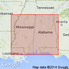
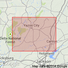
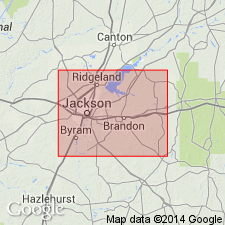
Forest Hill sand crops out in belt across MS from Yazoo Co. on the west through Hinds, Rankin, Scott, and Smith Cos, in which area it is interposed between belts of outcrops of Yazoo clay and Mint Spring marl member of Marianna limestone. From eastern Smith Co. to AL line through Jasper, Clarke, and Wayne Cos., it is underlain by and may interfinger with Red Bluff clay. Thickness is 68.5 ft at type locality (herein stated); thickness generally 100 ft.
Source: GNU records (USGS DDS-6; Reston GNULEX).

- Usage in publication:
-
- Forest Hill Sand
- Modifications:
-
- Overview
- AAPG geologic province:
-
- Mid-Gulf Coast basin
Summary:
The Bumpnose Limestone, Red Bluff Clay, and Forest Hill Sand of the Vicksburg Group (State usage) are facies equivalent strata that grade into one another laterally and vertically. In general, the Forest Hill is composed of nonmarine to nearshore marine, dark, very fine to fine-grained sand, silt, and laminated carbonaceous clay with lignite beds near the top and bottom of the unit. The unit is 100 ft thick in central and western MS and thins to the east. In southwestern AL, strata correlative to the Forest Hill of MS have often been assigned to the Red Bluff Clay. At St. Stephens Quarry, Washington Co., AL, one of the easternmost exposures, unit consists of 8.8 ft of dark-brown blocky, carbonaceous, sparingly fossiliferous clay.
Source: GNU records (USGS DDS-6; Reston GNULEX).
For more information, please contact Nancy Stamm, Geologic Names Committee Secretary.
Asterisk (*) indicates published by U.S. Geological Survey authors.
"No current usage" (†) implies that a name has been abandoned or has fallen into disuse. Former usage and, if known, replacement name given in parentheses ( ).
Slash (/) indicates name conflicts with nomenclatural guidelines (CSN, 1933; ACSN, 1961, 1970; NACSN, 1983, 2005, 2021). May be explained within brackets ([ ]).