

- Usage in publication:
-
- Forelle limestone*
- Modifications:
-
- Named
- Dominant lithology:
-
- Limestone
- AAPG geologic province:
-
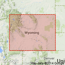
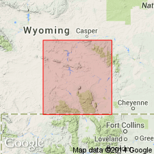
- Green River basin
Summary:
Named for exposures west of the "great springs" [Boswell spring?] 2 mi east of Laramie that cross the railroad at Forelle and Red Buttes, Albany Co, WY in the Greater Green River basin. No type locality designated. Consists of thin (4 to 20 ft thick), persistent, heavily bedded, pure limestone. Is nearly 20 ft thick near Forelle. Becomes gypsiferous to south where it varies from massive to thinly laminated, locally brecciated, and locally changes in lithology to shale. Has the fossil MYALINA PERATTENUATUS on the east side of Laramie basin. Other fossils (listed) found on east side of Red Mountain. This fauna is suggestive of late Pennsylvanian or possibly Permian of KS. Overlies the newly named Satanka shale. Underlies Chugwater formation. Geologic map; measured sections; columnar sections; [included? with Chugwater formations or diagrams?].
Source: GNU records (USGS DDS-6; Denver GNULEX).
- Usage in publication:
-
- Forelle limestone tongue
- Modifications:
-
- Revised
- AAPG geologic province:
-
- Green River basin
Summary:
Rank changed. Considered to be a tongue of the Phosphoria formation rather than as a distinct formation as previously thought. Loses its identity north and west of the Freezeout Hills, Carbon Co, WY. Shown on cross section between Red Mountain, Albany Co, WY, north to Freezeout Hills in the Greater Green River basin. Age of Phosphoria [and thus Forelle] is in doubt, but it is probably Permian.
Source: GNU records (USGS DDS-6; Denver GNULEX).
- Usage in publication:
-
- Forelle limestone
- Modifications:
-
- Areal extent
- AAPG geologic province:
-
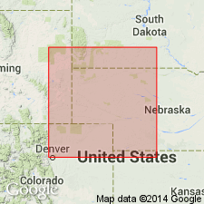
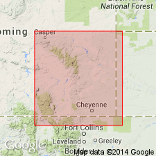
- Denver basin
- Powder River basin
Summary:
Pg. 2 (fig. 2), 6, 9. Forelle formation of Phosphoria group. Overlies Glendo shale (new); underlies Freezeout shale. [Age is Permian.]
Source: US geologic names lexicon (USGS Bull. 1200, p. 1385-1386).
- Usage in publication:
-
- Forelle Limestone Member*
- Modifications:
-
- Revised
- AAPG geologic province:
-
- Green River basin
Summary:
Reduced in stratigraphic rank and assigned as one of eight members to the Goose Egg Formation in Albany and Carbon Cos, WY in the Greater Green River basin. Overlies Glendo Shale Member, newly assigned to the Goose Egg. Underlies the newly named Difficulty Shale Member of the Goose Egg. Crops out discontinuously along east side Laramie and Front Ranges of WY and CO. Is equivalent to the Crinkly or Glennon Limestone Member of Lykins Formation of CO and to the lower part of the Spearfish Fm in SD. Connects with middle or upper part of Franson Member of Park City Formation. Is a 30 ft thick widespread unit recognized throughout eastern WY. Composed of a finely crystalline dolomitic limestone in the upper and lower parts, and an argillaceous limestone in the middle. Is characterized by crenulated laminae, thin beds, algal heads 3-4 ft in diameter in upper part. Changes to anhydrite and gypsum to east. Correlation chart; cross section. Late Permian age.
Source: GNU records (USGS DDS-6; Denver GNULEX).
- Usage in publication:
-
- Forelle Limestone Member*
- Modifications:
-
- Mapped 1:24k (Indian Hills quad, Jefferson Co, CO)
- Revised
- Dominant lithology:
-
- Limestone
- Siltstone
- AAPG geologic province:
-
- Denver basin
Summary:
Is Upper Permian member of Lykins Formation (Permian and Triassic?) mapped in central Jefferson Co, CO (Denver basin). Is fourth of five (ascending) members of Lykins. Outcrops in northeast part of quad in very narrow band along Hogback. Conformably overlies Bergen Shale Member (Permian) of Lykins; conformably underlies Strain Shale Member (Upper Permian and Triassic?) of Lykins. Map unit described as grayish-orange-pink, moderate-yellowish-brown, and yellowish-gray thin-bedded chert-bearing finely laminated, wavy, intricately folded and faulted sandy limestone; differential weathering of thin-bedded reddish-brown siltstone within unit results in two closely spaced small hogback ridges along much of valley east of Lyons Sandstone ridge. Thickness about 15-20 ft. Reassigned as a member of the Lykins Formation.
Source: GNU records (USGS DDS-6; Denver GNULEX).
For more information, please contact Nancy Stamm, Geologic Names Committee Secretary.
Asterisk (*) indicates published by U.S. Geological Survey authors.
"No current usage" (†) implies that a name has been abandoned or has fallen into disuse. Former usage and, if known, replacement name given in parentheses ( ).
Slash (/) indicates name conflicts with nomenclatural guidelines (CSN, 1933; ACSN, 1961, 1970; NACSN, 1983, 2005, 2021). May be explained within brackets ([ ]).