

- Usage in publication:
-
- Fontenelle member
- Modifications:
-
- Named
- Dominant lithology:
-
- Sandstone
- Shale
- AAPG geologic province:
-
- Green River basin
Summary:
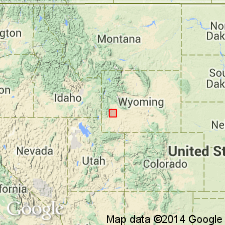
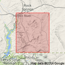
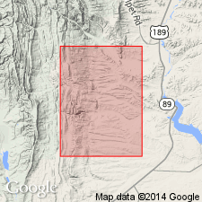
Named as a basal member of Green River formation for exposures about one-half mile south of Fontenelle Creek, Lincoln Co, WY in the Greater Green River basin. Extends into adjoining Sublette Co. Type locality is in sec 13, T24N, R114W. Conformably overlies Knight member of Wasatch, an easily recognized contact--of varicolored Knight beneath a persistent, buff, minutely cross-laminated sandstone of Fontenelle. Consists of alternating buff-brown, fine- to coarse-grained, thin-bedded to thick-bedded to blocky sandstone, and green and gray mudstone. In some places, the sandstones are lenticular or discontinuous with well developed laminations. Brick-brown concretions found in some of the thicker sandstones. Thin conglomerates of well-rounded pebbles and cobbles from Mesozoic rocks. Near Green River-New Fork River junction, about 6 mi east of Big Piney, Fontenelle interfingers with varicolored New Fork tongue (new) of Wasatch formation. In sec 14, T28N, R114W, the variegated New Fork is missing, and the entire sequence (300 ft thick) is alternating sandstone and shale of Fontenelle. Is a shoreline delta deposit. Fossil gastropods (listed). Is overlain by Laney member of Green River. May correlate with Tipton tongue of Green River. Cross section. Geologic map. Of Middle Eocene age.
Source: GNU records (USGS DDS-6; Denver GNULEX).
- Usage in publication:
-
- Fontenelle tongue*
- Modifications:
-
- Revised
- AAPG geologic province:
-
- Green River basin
Summary:
Stratigraphic rank term accepted as tongue, rather than member, of Green River formation in the Greater Green River basin. Is thought to merge downdip with the rest of the Green River. Thought to be contemporaneous with the Tipton tongue of the Green River. Is the equivalent of the Cathedral Bluffs and Tipton tongues of the Green River. Of Eocene age.
Source: GNU records (USGS DDS-6; Denver GNULEX).
- Usage in publication:
-
- Fontenelle tongue*
- Modifications:
-
- Revised
- AAPG geologic province:
-
- Green River basin
Summary:
Restricted stratigraphically in the Fort Hill area, Lincoln Co, WY in the Greater Green River basin, as a tongue of the Green River formation to only the basal 50 to 60 ft of the Fontenelle as defined by Donovan (1950). The overlying rocks formerly part of the Fontenelle, in the Fort Hill area where they are green (not red) mudstone and brown sandstone, are reassigned to the New Fork tongue of the Wasatch formation. Fontenelle conformably overlies the main body of the Wasatch formation. As restricted, consists of very thinly laminated, light-gray to white muddy limestone, marlstone, calcareous very fine grained sandstone, and calcareous mudstone. Of early Eocene age.
Source: GNU records (USGS DDS-6; Denver GNULEX).
- Usage in publication:
-
- Fontenelle Tongue*
- Modifications:
-
- Revised
- AAPG geologic province:
-
- Green River basin
Summary:
Eocene Fontenelle Tongue of Green River Formation overlies and intertongues with the La Barge Member (new name) of main body of Wasatch Formation in the Greater Green River basin of southwest WY. Intertongues westward into conglomerate member of Wasatch Formation, which is a facies peripheral to the basin.
Source: GNU records (USGS DDS-6; Denver GNULEX).
- Usage in publication:
-
- Fontenelle Tongue
- Modifications:
-
- Not used
Summary:
Work by several authors has shown that the Fontenelle Tongue of the Green River Formation is equivalent to the Tipton Shale Member of the Green River. Term Fontenelle should be "discarded."
Source: GNU records (USGS DDS-6; Denver GNULEX).
- Usage in publication:
-
- Fontenelle Tongue
- Modifications:
-
- Not used
Summary:
Donavan's (1950) Fontenelle Tongue (about 350 ft thick) of Green River Formation on Fontenelle Creek was bounded by the Knight Member of the Wasatch Formation below and New Fork Tongue of Wasatch above. The Fontenelle was later restricted (Oriel, 1961) to lower 50 ft of the original unit, and then Lawrence (1963) modified the restricted Fontenelle to include an additional overlying 75 ft. Lawrence's 125 ft thick Fontenelle was reassigned to the Tipton Shale Member of the Green River Formation by Sullivan (1980). The name Fontenelle which has had several definitions is not used in this report. The interval named Fontenelle by Donavan in the Fontenelle Creek area is redesignated (ascending): Scheggs Bed (new) of Tipton Shale Member and Farson Sandstone Member (new) of Green River Formation, and Alkali Creek Tongue (new) of Wasatch Formation in this report. Stratigraphic diagrams.
Source: GNU records (USGS DDS-6; Denver GNULEX).
For more information, please contact Nancy Stamm, Geologic Names Committee Secretary.
Asterisk (*) indicates published by U.S. Geological Survey authors.
"No current usage" (†) implies that a name has been abandoned or has fallen into disuse. Former usage and, if known, replacement name given in parentheses ( ).
Slash (/) indicates name conflicts with nomenclatural guidelines (CSN, 1933; ACSN, 1961, 1970; NACSN, 1983, 2005, 2021). May be explained within brackets ([ ]).