The National Geologic Map Database is migrating to a new infrastructure. We apologize for any service disruptions during this process.
|
|---|


- Usage in publication:
-
- Foley formation*
- Modifications:
-
- Original reference
- Dominant lithology:
-
- Sand
- Clay
- AAPG geologic province:
-
- Gulf Coast basin
Summary:
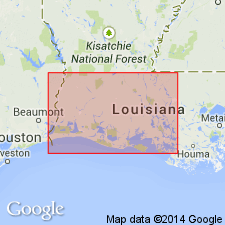
Pg. 56-61. Foley formation. Occurs in southwestern Louisiana subsurface. Sequence of fine- to medium-grained sands interbedded with soft to moderately hard gray-green to brown laminated clays penetrated by a number of water wells in vicinity of Oakdale. Thickness at Oakdale about 1,500 feet; at Mamou, 18 miles down dip, thickness is about 2,500 feet. Includes Mamou member above and Steep Gully member (both new). Underlies Williana formation; overlies Fleming formation. Age is Pliocene.
Named from town of Foley, central Allen Parish, southwestern LA. Name Oakdale has been used for other deposits.
Source: US geologic names lexicon (USGS Bull. 1200, p. 1381).
For more information, please contact Nancy Stamm, Geologic Names Committee Secretary.
Asterisk (*) indicates published by U.S. Geological Survey authors.
"No current usage" (†) implies that a name has been abandoned or has fallen into disuse. Former usage and, if known, replacement name given in parentheses ( ).
Slash (/) indicates name conflicts with nomenclatural guidelines (CSN, 1933; ACSN, 1961, 1970; NACSN, 1983, 2005, 2021). May be explained within brackets ([ ]).