

- Usage in publication:
-
- Fluorspar Canyon formation*
- Modifications:
-
- Named
- Dominant lithology:
-
- Dolomite
- Limestone
- AAPG geologic province:
-
- Great Basin province
Summary:
Fluorspar Canyon formation. Medium- to dark-gray, locally petroliferous fine- to medium-grained saccharoidal dolomite with minor but conspicuous zones of deep pink and brown quartzitic and dolomitic sand and a thick zone of medium-gray limestone. Three partial sections measured with total thickness of about 1,700 feet. Basal part of formation, 300 feet thick, crops out on south side of Tarantula Canyon and conformably overlies Lone Mountain dolomite. Second incomplete section, composed of three units, 550, 75, and 215 feet thick, respectively, is exposed on north end of Razorback Ridge. Third incomplete section, 580 feet thick, is 1.5 miles northeast of Meiklejohn Peak; overlies Meiklejohn formation (new). Age is Middle Devonian.
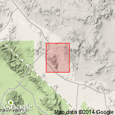
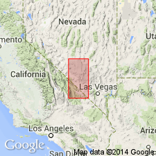
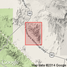
Type section: on north end of Razorback Ridge, at head of Fluorspar Canyon, Bare Mountain 15-min quadrangle, Nye Co., southern NV. Named from Fluorspar Canyon.
Source: US geologic names lexicon (USGS Bull. 1350, p. 262).
- Usage in publication:
-
- Fluorspar Canyon Formation†
- Modifications:
-
- Abandoned
- AAPG geologic province:
-
- Great Basin province
Summary:
Fluorspar Canyon Formation abandoned; its rocks now assigned to middle part of Nevada Formation. [Adopted by the USGS (see Changes in stratigraphic nomenclature, 1973, USGS Bull. 1395-A, p. A16-A17).]
[†Nevada Formation later abandoned (Hose and others, 1982, USGS Prof. Paper 1182, p. 1).]
Source: Changes in stratigraphic nomenclature, 1973 (USGS Bull. 1395-A, p. A16-A17).
- Usage in publication:
-
- "Fluorspar Canyon Formation of former usage"
- "rocks of Tarantula Canyon"
- Modifications:
-
- Mapped 1:24k in Nye Co.
- Age modified
- Dominant lithology:
-
- Dolomite
- Limestone
- AAPG geologic province:
-
- Great Basin province
Summary:
Pl. 1 (geol. map); [pamphlet missing (Nov. 11, 2007)]. Rocks previously assigned to the †Fluorspar Canyon Formation by Cornwall and Kleinhampl (1961) and later to the middle part of †Nevada Formation by Cornwall (1972), are here included in 2 informal units, "Fluorspar Canyon Formation of former usage" and "rocks of Tarantula Canyon," mapped locally in the Bare Mountain area, Nye County, Nevada.
"Fluorspar Canyon Formation of former usage" (Df), present along Razorback Ridge (type) and southeast of Joshua Hollow, is described as a steep slope and cliff-forming unit consisting predominantly of medium to thick layers of light- to dark-gray, fine- to medium-grained dolomite and limy dolomite containing limestone and quartzite beds in some intervals. Divided into 4 subunits. Grades downward into Lone Mountain Dolomite; basal contact is indistinct. Thickness of incomplete section at Razorback Ridge more than 256.2 m (840 feet; Cornwall and Kleinhampl, 1961). Contains abundant stromatoporids (AMPHIPORA) in upper part. Age is Devonian.
"Rocks of Tarantula Canyon" (Dtc), present at mouth and along south side of Tarantula Canyon, is described as a moderately resistant, light- to dark-gray, dolomite, limestone, silty dolomite, and silty limestone. Contains debris flows of detrital carbonate rock as thick as 10 m. Upper quarter of unit is mostly limestone, whereas remainder is predominantly dolomite. Thickness is 91.5 m (300 feet) near mouth of Tarantula Canyon (= the basal 300 feet of †Fluorspar Canyon Formation of Cornwall and Kleinhampl, 1961). Upper contact is abruptly gradational with overlying siltstone of Eleana Formation. Basal contact is gradational and defined by change from light- to dark-gray, poorly stratified, craggy-weathering dolomite. A moderately distinct break in slope coincides with basal contact. Age is Devonian; upper part yielded Middle to Late Devonian age conodonts.
Source: Publication.
For more information, please contact Nancy Stamm, Geologic Names Committee Secretary.
Asterisk (*) indicates published by U.S. Geological Survey authors.
"No current usage" (†) implies that a name has been abandoned or has fallen into disuse. Former usage and, if known, replacement name given in parentheses ( ).
Slash (/) indicates name conflicts with nomenclatural guidelines (CSN, 1933; ACSN, 1961, 1970; NACSN, 1983, 2005, 2021). May be explained within brackets ([ ]).