

- Usage in publication:
-
- Florissant lake beds*
- Modifications:
-
- Original reference
- Dominant lithology:
-
- Ash
- Tuff
- Shale
- AAPG geologic province:
-
- Denver basin
- South Park basin
Summary:
Florissant lake beds. Almost wholly volcanic ashes, which were probably showered upon waters of the lake forming soft and crumbling tuffs and mud shales. Predominantly andesitic, with detritus of basalt and rhyolite. Thickness 50 feet. Older than Alnwick and High Park lake beds. [USGS adopted (ca. 1938) Tertiary (late Miocene) age for this unit.]
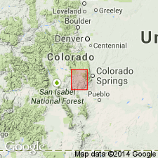
Named from Florissant, Teller Co., Pikes Peak region, eastern CO.
Source: US geologic names lexicon (USGS Bull. 896, p. 745).
- Usage in publication:
-
- Florissant Lake Beds*
- Modifications:
-
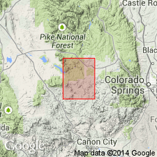
- Mapped 1:62.5k (Teller and Park Cos, CO)
- Dominant lithology:
-
- Conglomerate
- Tuff
- Breccia
- Shale
- Mudstone
- AAPG geologic province:
-
- South Park basin
- Denver basin
Summary:
Is Oligocene formation mapped in western Teller Co, CO (Denver basin) and southeastern Park Co, CO (South Park basin). Most commonly unconformably overlies Pikes Peak Granite (Precambrian Y). Locally overlain by upper member of the Thirtynine Mile Andesite (Oligocene). Map unit described as pink arkosic conglomerate, purple and gray andesitic tuff and volcanic mudflow breccia, white pumiceous tuff, and gray volcanic conglomerate. Beds are generally horizontal, but locally dip moderately toward center of basin. Aggregate thickness less than 150 ft (50 m). Tuffaceous shale and mudstone beds near the middle of the sequence contain abundant plant and insect fossils; the underlying andesitic tuff beds and mudflows contain stumps and logs of fossilized Sequoia trees.
Source: GNU records (USGS DDS-6; Denver GNULEX).
- Usage in publication:
-
- Florissant Formation*
- Modifications:
-
- Redefined
- Dominant lithology:
-
- Conglomerate
- Sandstone
- Mudstone
- Siltstone
- Shale
- Tuff
- AAPG geologic province:
-
- Denver basin
Evanoff, Emmett, McIntosh, W.C., and Murphey, P.C., 2001, Stratigraphic summary and Ar/Ar geochronology of the Florissant Formation, Colorado: Denver Museum of Nature and Science Proceedings, 4th series, no. 1, p. 1-16.
Summary:
Florissant Formation. Name Florissant Lake Beds does not conform to modern criteria set forth by the NACSN (1983, art. 22d) that states depositional environments should not be used in the definition of a lithostratigraphic unit. Thus name of formation is herein redefined as Florissant Formation.
Consists of conglomerates, shales, mudstones, and some siltstones. Composite of several sections measured south of town of Florissant (most sections are within boundary of Florissant Fossil Beds National Monument). Informally subdivided into (descending): (1) upper pumice conglomerate unit, white and pink pumice conglomerate beds in channel fills, thickness up to 22.8 m; (2) upper shale unit, alternating paper shale and pumice conglomerate beds, thickness up to 5.6 m; (3) caprock conglomerate, granular muddy conglomerate beds with volcanic and granite gravel, and near base, large blocks of shale, thickness 7.3 m; (4) middle shale unit, paper shale, pumice conglomerate and volcanic ash beds, thickness up to 9 m, includes most of famous fossil plant and insect localities; (5) lower mudstone unit, light-gray tuffaceous mudstone beds and scattered pumice conglomerate beds, includes ribbon sandstones, and at top, thick structureless sandy mudstone, thickness 10.4 m (possibly up to 20.4 m), = lowest beds exposed within Florissant Beds National Monument; (6) lower shale unit, alternating paper shale and gray siltstone beds with rare pumice and granular conglomerate beds, thickness up to 11.4 m; and (7) basal sequence, basal conglomerate beds overlain by gravel-bearing mudstone beds. Total thickness estimated to be 74 m. Unconformably overlies Wall Mountain Tuff (average 36.73 +/- 0.07 Ma, citing McIntosh and Chapin, 1994). Fossils. Mammal fossils, MESOHIPPUS and MERYCOIDADON, indicate a Chadronian NALMA (citing Wood and others, 1941). Single-crystal Ar/Ar analyses of sanidine from pumice in sandstone and debris flow deposits in upper part of formation yielded a mean age of 34.07 +/-0.10 Ma. Age is early Tertiary (late Eocene).
Source: Publication.
For more information, please contact Nancy Stamm, Geologic Names Committee Secretary.
Asterisk (*) indicates published by U.S. Geological Survey authors.
"No current usage" (†) implies that a name has been abandoned or has fallen into disuse. Former usage and, if known, replacement name given in parentheses ( ).
Slash (/) indicates name conflicts with nomenclatural guidelines (CSN, 1933; ACSN, 1961, 1970; NACSN, 1983, 2005, 2021). May be explained within brackets ([ ]).