

- Usage in publication:
-
- Floris Formation
- Modifications:
-
- Named
- Dominant lithology:
-
- Coal
- Shale
- Mudstone
- Limestone
- AAPG geologic province:
-
- Iowa shelf
Summary:
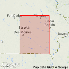
Named as one of four formations of Cherokee Group of Des Moines Supergroup. Overlies the newly named Kalo Formation of the Cherokee. Underlies the newly named Whitebreast Coal Member of the newly named Swede Hollow Formation, upper formation of the Cherokee. Named for town of Floris, northeast Davis Co, IA on the Iowa shelf. Type area is a series of cuts along a north-south road on east edge of sec 29, T72N, R13W, east of Ottumwa, Wapello Co, IA on the Iowa shelf. Has few traceable beds. Divided into the newly named Laddsdale Coal Member at base, unnamed sequence, Carruthers Coal Member (new), and an upper unnamed sequence. Laddsdale consists of coal beds separated by dark gray shale, gray silty mudstone, two thin, gray, fossiliferous limestone beds. The unnamed sequence above Laddsdale includes brown to green, very fine- to fine-grained sandstone, brown mudstone, and gray shale. The Carruthers consists of coal, gray mudstone, brown sandstone. The upper unnamed sequence is mudstone, limestone and sandstone. Coal beds form top and base of named members at their types. Is 100 ft thick at type. Is unduly distributed over the Iowa shelf in southeast and south central IA. Ranges between 65 to 190 ft thick. Thins south. Thickens to north. Dominated by fluvial and deltaic sedimentation. Marine and lagoonal influence is local. Stratigraphic chart. Cross section. Graphic sections. Of Desmoinesian, Pennsylvanian age.
Source: GNU records (USGS DDS-6; Denver GNULEX).
For more information, please contact Nancy Stamm, Geologic Names Committee Secretary.
Asterisk (*) indicates published by U.S. Geological Survey authors.
"No current usage" (†) implies that a name has been abandoned or has fallen into disuse. Former usage and, if known, replacement name given in parentheses ( ).
Slash (/) indicates name conflicts with nomenclatural guidelines (CSN, 1933; ACSN, 1961, 1970; NACSN, 1983, 2005, 2021). May be explained within brackets ([ ]).