- Usage in publication:
-
- Florena shales
- Modifications:
-
- Original reference
- Dominant lithology:
-
- Shale
- AAPG geologic province:
-
- Nemaha anticline
Summary:
Pg. 712. Florena shales. Yellowish fossiliferous shales, heretofore called "Cottonwood shales" (preoccupied). Thickness of 13 feet near Strong, Chase County, Kansas, decreasing to 2 or 3 feet in the northern part of state. Underlies Neosho member and forms lower part of Garrison formation in Council Grove stage. Overlies Cottonwood limestone [called "Alma" in early part of article; name Alma replaced with Cottonwood at conclusion of article]. Age is late Paleozoic.
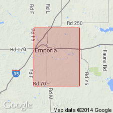
Named from exposures in quarries near Florena, Marshall Co., eastern KS.
Source: US geologic names lexicon (USGS Bull. 896, p. 743); GNC KS-NE Permian Corr. Chart, Oct. 1936; supplemental information from GNU records (USGS DDS-6; Denver GNULEX).
- Usage in publication:
-
- Florena shale member
- Modifications:
-
- Revised
- AAPG geologic province:
-
- Forest City basin
Summary:
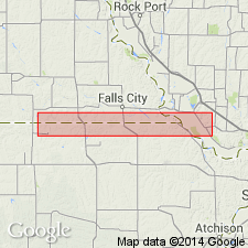
Pg. 7; [see also Condra and Busby 1933 entry under Beattie]. Florena shale, middle member of Beattie limestone formation of Council Grove group. Olive colored at top, middle and base light gray with much calcitic material and quite fossiliferous (abundant CHONETES GRANULIFER). Thickness 5 to 10 feet. Overlies Cottonwood limestone member and underlies Morrill limestone member. Age is Permian. [This classification was followed by R.C. Moore, 1936 (Kansas Geol. Survey Bull., no. 22).]
Source: Publication; GNC KS-NE Permian Corr. Chart, Oct. 1936.

- Usage in publication:
-
- Florena shale member*
- Modifications:
-
- Overview
- AAPG geologic province:
-
- Nemaha anticline
Summary:
Florena shale member of Garrison shale of Council Grove group. Adopted by the USGS as lower member of Garrison formation. Underlies Neosho shale member of Garrison and overlies Cottonwood limestone. Recognized in eastern Kansas and southeastern Nebraska. Named from exposures in quarries near Florena, Marshall Co., eastern KS.
See also under Beattie formation and under †Garrison shale, which R.C. Moore discarded in 1936 [Kansas Geol. Survey Bull., no. 22, p. 50, 251].
Source: US geologic names lexicon (USGS Bull. 896, p. 743); GNC KS-NE Permian Corr. Chart, Oct. 1936.
- Usage in publication:
-
- Florena shale member
- Modifications:
-
- Overview
- AAPG geologic province:
-
- Nemaha anticline
Summary:
Pg. 47. Florena shale member, middle member of Beattie limestone. Underlies Morrill limestone member; overlies Cottonwood limestone member. Consists of highly fossiliferous gray shale containing thin limestone beds in southern Kansas. Thickness 3 to 18 feet. Age is Early Permian (Wolfcamp).
Source: US geologic names lexicon (USGS Bull. 1200, p. 1376).
- Usage in publication:
-
- Florena Shale Member*
- Modifications:
-
- Areal extent
- Biostratigraphic dating
- AAPG geologic province:
-
- Nemaha anticline
Summary:
Pg. 3 (fig. 1), 53, tbl. 1, pl. 5. Florena shale member, middle member of Beattie limestone of Council Grove group. Underlies Morrill limestone member; overlies Cottonwood limestone member. Subdivided into two zones, following Condra and Upp (1931, Nebraska Geol. Survey Bull., 2nd ser., no. 6, p. 17). The lower zone, generally the basal 2 or 3 feet of the member, is tan to gray, clayey to silty, and locally very fossiliferous. Locally, toward the south, are lenses of limestone. The lower part of this zone very likely represents a transitional zone from the Cottonwood into the Florena. The upper zone is as much as two-thirds of the Florena. It is generally gray to olive-drab blocky clay shale locally containing a sparse fauna. In most exposures it is nonfossiliferous, and contains secondary calcite filling fractures and geodes. In general, the Florena shale member thickens southward. Thickness 8 to 15 feet in Chase County (Moore and others, 1951, Kansas Geol. Survey [Report], v. 11, p. 13) and 2 feet in Marshall County (Walters, 1954, Kansas Geol. Survey Bull., no. 106, p. 47). Most characteristic fossil in this member is CHONETES GRANULIFER, which is more abundant than any other fossil. Distribution of fossils collected from the Florena is given in table 1 (sheet 2). Fossils include: fusulinids, coelenterates, echinoderms, bryozoans, brachiopods, pelecypods, gastropods, scaphopods, cephalopods, trilobites. Paleontology section provides detailed discussions of species (p. 55-97). Age is Early Permian. Report includes measured sections (see nos. 236, 252, 288, 298, and 329), correlation diagrams, fossil distribution charts. [Report submitted for publication before release of 1961 ACSN code, recommending capitalization of formal names.]
Source: Publication.
- Usage in publication:
-
- Florena Shale Member
- Modifications:
-
- Overview
- AAPG geologic province:
-
- Nemaha anticline
Summary:
(Paleozoic Era; Permian System by H.G. O'Connor, D.E. Zeller, C.K. Bayne, J.M Jewett, and Ada Swineford, p. 47.) Florena Shale Member of Beattie Limestone of Council Grove Group. A highly fossiliferous calcareous, gray to tannish-gray shale containing thin nodular limestone beds. Occurs in southeastern Kansas. From southern Wabaunsee County to northern Greenwood County, includes dolomitic shale. CHONETES GRANULIFER is abundant. In southern outcrops the variety of fossils is greater than in the north. The fauna contains numerous species of pelecypods and brachiopods, and well-preserved specimens of a small trilobite are common locally. Thickness about 3 to 18 feet. Overlies Cottonwood Limestone Member and underlies Morrill Limestone Member, also of Beattie Limestone. Age is Early Permian (Gearyan of O'Connor, 1963, AAPG Bull., v. 47, p. 1873-1877).
Source: Publication.
For more information, please contact Nancy Stamm, Geologic Names Committee Secretary.
Asterisk (*) indicates published by U.S. Geological Survey authors.
"No current usage" (†) implies that a name has been abandoned or has fallen into disuse. Former usage and, if known, replacement name given in parentheses ( ).
Slash (/) indicates name conflicts with nomenclatural guidelines (CSN, 1933; ACSN, 1961, 1970; NACSN, 1983, 2005, 2021). May be explained within brackets ([ ]).

