The National Geologic Map Database is migrating to a new infrastructure. We apologize for any service disruptions during this process.
|
|---|


- Usage in publication:
-
- Flint Hill sandstone
- Modifications:
-
- Original reference
- AAPG geologic province:
-
- Ozark uplift
Summary:
Pg. 6, fig. 1. Flint Hill sandstone in Little Osage member of Fort Scott formation. Channel type sandstone and siltstone that occurs above Blackwater Creek shale in Little Osage member and below Higginsville limestone member. Name credited to A.G. Unklesbay. [Age is Middle Pennsylvanian (Desmoinesian).]
[Greene and Searight state type section is in NW/4 SE/4 sec. 11. Thompson and Gentile (2004) state type appears to be a composite of 2 sections: (1) upper part measured in west bluff of small stream in SW/4 SW/4 sec. 11; (2) lower, and best section, in roadcuts on south side MO Highway 124 in center W/2 SW/4 sec. 11.]
Source: US geologic names lexicon (USGS Bull. 1200, p. 1373-1374).
- Usage in publication:
-
- Flint Hill sandstone
- Modifications:
-
- Principal reference
- AAPG geologic province:
-
- Ozark uplift
Summary:
Pg. 96, 97. Flint Hill sandstone in Little Osage member of Fort Scott formation. At type section, consists of gray to yellowish-brown fine- to medium-grained massive resistant friable calcareous sandstone; locally contains brownish-red and purple streaks. [Thickness 5 feet 9 inches. Age is Middle Pennsylvanian (Desmoinesian).]
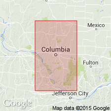
Type section: in W/2 SW/4 sec. 11, T. 50 N., R. 13 W., Boone Co., central MO. Named from Flint Hill near Flint Hill School.
[Greene and Searight (1949) state type section is in NW/4 SE/4 sec. 11. Thompson and Gentile (2004) state type appears to be a composite of 2 sections: (1) upper part measured in west bluff of small stream in SW/4 SW/4 sec. 11; (2) lower, and best section, in roadcuts on south side MO Highway 124 in center W/2 SW/4 sec. 11.]
Source: US geologic names lexicon (USGS Bull. 1200, p. 1373-1374).
- Usage in publication:
-
- Flint Hill sandstone facies
- Modifications:
-
- Reference
- Revised
- Dominant lithology:
-
- Sandstone
- AAPG geologic province:
-
- Lincoln anticline
- Ozark uplift
Summary:
Pg. B177-B178, Appendix B. Flint Hill sandstone facies (informal) in Blackwater Creek Shale Member of Little Osage Formation of Fort Scott subgroup [informal] of Marmaton Group. Ranges from a sandstone to a calcareous silty sandstone, and grades laterally into the shale of the Blackwater Creek Member. It has also channeled downward through much of the Blackwater Creek Member in many places, and may even have cut out the Houx Limestone Member and at least part of the Binkley Shale Member. Often regarded as a separate member of the Little Osage Formation, we consider the Flint Hill to represent a lateral accretionary sandstone deposit in a fluvial-delta-plain environment within the Blackwater Creek Shale Member. Age is Middle Pennsylvanian (Desmoinesian).
Reference section: along west-facing highwall of abandoned coal surface mine on MO Natl. Guard property, 1.5 mi west of U.S. Highway 63, 2.5+ mi southwest of south edge of Macon, in SW/4 NE/4 sec. 5, T. 56 N., R. 14 W., Macon 7.5-min quadrangle, Macon Co., central MO.
[Greene and Searight (1949) state type section is in NW/4 SE/4 sec. 11. Thompson and Gentile state type appears to be a composite of 2 sections: (1) upper part measured in west bluff of small stream in SW/4 SW/4 sec. 11; (2) lower, and best section, in roadcuts on south side MO Highway 124 in center W/2 SW/4 sec. 11.]
["Subgroup" not recognized as a formal stratigraphic rank term (CSN, 1933; ACSN, 1961, 1970; NACSN, 1983, 2005, 2021). Considered informal and should not be capitalized.]
Source: Publication.
For more information, please contact Nancy Stamm, Geologic Names Committee Secretary.
Asterisk (*) indicates published by U.S. Geological Survey authors.
"No current usage" (†) implies that a name has been abandoned or has fallen into disuse. Former usage and, if known, replacement name given in parentheses ( ).
Slash (/) indicates name conflicts with nomenclatural guidelines (CSN, 1933; ACSN, 1961, 1970; NACSN, 1983, 2005, 2021). May be explained within brackets ([ ]).