

- Usage in publication:
-
- Fleming beds
- Modifications:
-
- Original reference
- Dominant lithology:
-
- Clay
- Sand
- AAPG geologic province:
-
- Gulf Coast basin
Summary:
Pg. 45, 62. Fleming beds. Clays and sands or sandy clays, dark blue, pale blue, brown, red, yellow, and pale green, thinly laminated and partially stratified and massive. Thickness 260 feet. Overlies Fayette sands and sandstones and underlies Quaternary clays. [Age is late Miocene and Pliocene(?).]
[Named from Fleming, Tyler Co., eastern TX.]
Source: US geologic names lexicon (USGS Bull. 896, p. 741-742).
- Usage in publication:
-
- Fleming clay*
- Modifications:
-
- Areal extent
- AAPG geologic province:
-
- Gulf Coast basin
Summary:
Pg. 72-74. Fleming clay consists of 200 to 500 feet of gray, white, and bluish white, bedded, calcareous clays with numerous small concretions of lime and some lenses of sand, underlying Dewitt formation and unconformably overlying Catahoula sandstone. Fossils. Assigned to basal Miocene.
Recognized in Newton, Jasper, Tyler, Polk, San Jacinto, Walker, and Grimes Cos., eastern TX.
Source: US geologic names lexicon (USGS Bull. 896, p. 741-742).
- Usage in publication:
-
- Fleming beds
- Modifications:
-
- Revised
- AAPG geologic province:
-
- Gulf Coast basin
Summary:
Pg. 447-475. Fleming beds include all sediments between Corrigan sands and Lafayette or Reynosa sands between Sabine and Navasota Rivers, eastern Texas. Is = Lagarto, Lapara, and possibly Oakville. Thickness 1500+/- feet. [Age is late Miocene and Pliocene(?).]
Source: US geologic names lexicon (USGS Bull. 896, p. 741-742).
- Usage in publication:
-
- Fleming clay*
- Modifications:
-
- Revised
- AAPG geologic province:
-
- Gulf Coast basin
Summary:
Divided Fleming clay of eastern Texas into Pascagoula clay (above) and Hattiesburg clay (below). [Age is late Miocene and Pliocene(?).]
Source: US geologic names lexicon (USGS Bull. 896, p. 741-742).

- Usage in publication:
-
- Fleming beds
- Modifications:
-
- Areal extent
- AAPG geologic province:
-
- Gulf Coast basin
Summary:
Pg. 81, 88-89. Fleming beds (Miocene and Pliocene) overlie Corrigan or Catahoula and are = Lagarto, Lapara, and Oakville. Thickness 1500+/- feet.
Source: US geologic names lexicon (USGS Bull. 896, p. 741-742).
- Usage in publication:
-
- Fleming beds
- Modifications:
-
- Areal extent
- AAPG geologic province:
-
- Gulf Coast basin
Summary:
Pg. 36-37. It is probable that some, if not all, of Lagarto clays, Lapara sands, and Oakville sands may be correlated with some of various phases of Fleming beds. [Age is late Miocene and Pliocene(?).]
Source: US geologic names lexicon (USGS Bull. 896, p. 741-742).
- Usage in publication:
-
- Fleming formation
- Modifications:
-
- Areal extent
- AAPG geologic province:
-
- Gulf Coast basin
Summary:
Pg. 1031-1052. Fleming formation. Immediately underlies Lafayette formation and overlies Catahoula sandstone. Thickness 1,100 to 2,600 feet. Is = Lagarto clays, Lapara sands, and Oakville sandstone of region west of Brazos River. [Age is late Miocene and Pliocene(?).]
Source: US geologic names lexicon (USGS Bull. 896, p. 741-742).

- Usage in publication:
-
- Fleming clay
- Modifications:
-
- Overview
- AAPG geologic province:
-
- Gulf Coast basin
Summary:
C.W. Cooke and Julia Gardner, 1930 (personal statement). Fleming clay is of late Miocene and possibly early Pliocene age; is = Pacagoula clay; and is younger than Oakville sandstone and Hattiesburg clay.
Additional note: The USGS discarded this name from its classification in 1932.
Source: US geologic names lexicon (USGS Bull. 896, p. 741-742).

- Usage in publication:
-
- Fleming group
- Modifications:
-
- Revised
- AAPG geologic province:
-
- Gulf Coast basin
Summary:
Pg. 530, 727. Applied Fleming group to the Miocene and Pliocene beds between Catahoula formation and Goliad formation, and divided the group into Lagarto formation [restricted] and Oakville formation.
Source: US geologic names lexicon (USGS Bull. 896, p. 741-742).
- Usage in publication:
-
- Fleming formation
- Modifications:
-
- Revised
- AAPG geologic province:
-
- Gulf Coast basin
- Arkla basin
Summary:
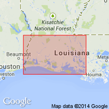
Pg. 150-173, geol. map. Fleming formation of Grand Gulf group. In surface exposures in Rapides Parish, Louisiana, divided into (ascending) Lena, Carnahan Bayou, Dough Hills, Williamson Creek, Castor Creek, and Blounts Creek members (all new). Overlies Catahoula formation of Grand Gulf; underlies Pleistocene. Age is Miocene.
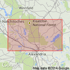
In western Rapides Parish, members are separately mapped; Carnahan Bayou member extends into adjacent Vernon Parish, and Lena and Carnahan Bayou members extend north into Natchitoches Parish. In eastern Rapides Parish, Fleming is mapped undivided.
Source: US geologic names lexicon (USGS Bull. 1200, p. 1371-1372); supplemental information from GNU records (USGS DDS-6; Denver GNULEX).
- Usage in publication:
-
- Fleming formation
- Modifications:
-
- Areal extent
- AAPG geologic province:
-
- Gulf Coast basin
Summary:
Pg. 977-1011. Fleming formation. In light of new age determinations, it is believed that term Fleming formation is applicable to clay beds near Burkeville, [Newton County], Texas, and that term Lagarto, formerly used, is not. [Age is Miocene.]
Source: US geologic names lexicon (USGS Bull. 1200, p. 1371-1372).
- Usage in publication:
-
- Fleming group
- Modifications:
-
- Revised
- AAPG geologic province:
-
- Gulf Coast basin
Summary:
Pg. 1721-1726. Fleming group. In this report, Fleming is considered a group name including both Oakville and Cuero (new) formations. Unconformably overlies Catahoula formation; unconformably underlies Goliad formation. [Age is Miocene.]
Source: US geologic names lexicon (USGS Bull. 1200, p. 1371-1372).
- Usage in publication:
-
- Fleming (Lagarto) formation
- Modifications:
-
- Biostratigraphic dating
- AAPG geologic province:
-
- Gulf Coast basin
Summary:
Fleming (Lagarto) formation. New faunal evidence leads to conclusion that the Fleming is middle Miocene in age.
Source: US geologic names lexicon (USGS Bull. 1200, p. 1371-1372).
- Usage in publication:
-
- Fleming formation
- Modifications:
-
- Areal extent
- AAPG geologic province:
-
- Gulf Coast basin
Summary:
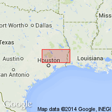
Pg. 52 (table 2), 55-56. Fleming formation in subsurface in southwestern Louisiana, underlies Foley formation (new). [Age is Miocene.]
Source: US geologic names lexicon (USGS Bull. 1200, p. 1371-1372).
- Usage in publication:
-
- Fleming Formation
- Modifications:
-
- Mapped 1:250k
- Dominant lithology:
-
- Clay
- Silt
- Sand
- AAPG geologic province:
-
- Gulf Coast basin
Summary:
Pamphlet [p. 2]. Fleming Formation. Clay, silt, and sand; mostly clay, commonly calcareous, calcareous concretions locally; silt and sand indurated, locally predominant; light gray to yellowish gray; weathers light gray to medium gray, locally red beneath Willis, forms brownish-black soil; thickness 1,300 to 1,450 feet. Lies below Willis Formation (Pleistocene) and above Catahoula Formation (Miocene). Age is Miocene.
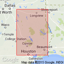
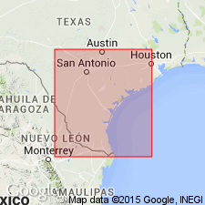
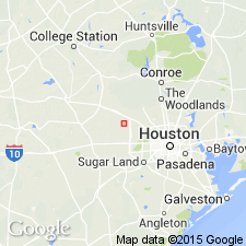
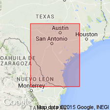
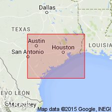
[Mapped in Grimes, Jasper, Montgomery, Newton, Polk, San Jacinto, Trinity, Tyler, and Walker Cos., TX.]
Source: Publication.

- Usage in publication:
-
- Fleming Formation
- Modifications:
-
- Mapped 1:250k
- Dominant lithology:
-
- Clay
- Sandstone
- AAPG geologic province:
-
- Gulf Coast basin
Summary:
Fleming Formation. Clay and sandstone; clay, commonly calcareous, forms brownish black soil; sandstone, medium- to coarse-grained, calcareous, thick-bedded, some cross-bedding, light yellowish gray to light gray; weathers light gray to medium gray. Thickness about 1,200 feet. Overlies Oakville Sandstone (Miocene); underlies Goliad Formation (Pliocene) or Willis Formation (Pleistocene). Locally contains reworked Cretaceous fossils. Age is Miocene.
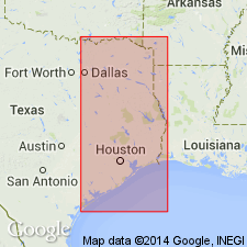
Mapped in De Witt, Lavaca, Colorado, Fayette, and Austin Cos., southeastern TX.
Source: Modified from GNU records (USGS DDS-6; Denver GNULEX).

- Usage in publication:
-
- Fleming Formation
- Modifications:
-
- Areal extent
- AAPG geologic province:
-
- Gulf Coast basin
Summary:
Fleming Formation. Clay and sandstone; clay, commonly calcareous, forms brownish-black soil; sandstone, medium-grained, calcareous, thick-bedded, some cross-bedding, light yellowish gray to light gray; some quartz and chert pebbles; fossil wood and vertebrate fossils locally common. [Thickness not stated.] Lies above Oakville Sandstone (Miocene) and below Goliad Formation (Pliocene). Age is Miocene.
Not separately mapped. Mapped with Oakville [in Duval, Jim Wells, Live Oak, Bee, and Karnes Cos., southern TX].
Source: Publication.
For more information, please contact Nancy Stamm, Geologic Names Committee Secretary.
Asterisk (*) indicates published by U.S. Geological Survey authors.
"No current usage" (†) implies that a name has been abandoned or has fallen into disuse. Former usage and, if known, replacement name given in parentheses ( ).
Slash (/) indicates name conflicts with nomenclatural guidelines (CSN, 1933; ACSN, 1961, 1970; NACSN, 1983, 2005, 2021). May be explained within brackets ([ ]).