- Usage in publication:
-
- Flaxville formation
- Modifications:
-
- [Biostratigraphic dating]
- AAPG geologic province:
-
- Williston basin
Collier, A.J., 1917, Age of the high gravels of the Northern Great Plains, [Montana], [abs.]: Washington Academy of Sciences Journal, Geological Society of Washington 314th meeting, Cosmos Club, Washington, DC, Jan. 24, 1917, p. 194-195.
Summary:
Flaxville formation. Brownish to ash-gray, silt, sand, and gravel, and white marl, from a few feet to 100 feet thick. Generally noncoherent but locally cemented with calcite, and forms prominent outcrops, often marked by cross-bedding. The gravel is characterized by material from Rocky Mountains. Is found on four extensive plateaus ranging in elevation from 2,700 feet, south of Redstone, to 3,200 feet, in west side of Boundary Plateau. Fragments of vertebrate fossils from the formation at 27 localities (in wells, railroad cuts, badger holes, and natural exposures) pronounced by J.W. Gidley to be not older than Miocene nor younger than [early] Pliocene.
[GNC remark (June 26, 2014): For several decades now geologists have cited Collier and Thom, Jr.'s 1918 USGS Prof. Paper 108-J as the original reference of the Flaxville, not this publication, as cited in US geologic names lexicon, USGS Bull. 1200, p. 1370-1371.]
Source: US geologic names lexicon (USGS Bull. 896, p. 741).

- Usage in publication:
-
- Flaxville gravel*
- Modifications:
-
- [Original reference]
- Dominant lithology:
-
- Gravel
- Sand
- Clay
- AAPG geologic province:
-
- Williston basin
Summary:
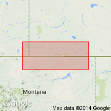
Pg. 179-184. Flaxville gravel. Named for town of Flaxville, [Sheridan County], northern Montana, on Scobey branch of Great Northern Railway. Deposited in Miocene or early Pliocene time. [Lists fossils.] Caps a series of even-topped plateaus ranging in altitude from 2,600+/- feet at its eastern end, a few miles south of Redstone, to 3,200 feet in western front of Boundary Plateau in Cherry Creek quadrangle. Is from a few feet to 100 feet thick. Rests on eroded surfaces of Fort Union, Lance, and Bearpaw formations. [Mapped over area extending from east of 105 deg. to west of 110 deg., both north and south of 49 deg. parallel.] Generally composed of yellowish to ash-gray gravel, clay, and sand, but in some places contains beds of white marl and volcanic ash. The gravel consists of well-rounded pebbles from less than 1 inch to 1 foot or more diameter, of quartzite and argillite derived from Rocky Mountains. Pebbles of limestone from same source may have been dissolved and the lime redeposited as cementing material and beds of marl. Materials mostly noncoherent and easily excavated by well diggers, though beds of hard sandstone and conglomerate cemented with calcite from 1 foot to several feet thick are encountered in most wells. In places thoroughly cemented with calcite and forms prominently outcropping ledges of sandstone and conglomerate. In railway cuts west of Flaxville, where best collection of fossils was made, about half of exposed material is gravel and remainder clay and sand, with about 1 foot of marl or concretionary calcite. Bedding irregular. [Extends into Saskatchewan and Alberta, Canada.]
[GNC remark (June 26, 2014): For the past several decades geologists have cited this publication as the original reference.]
Source: US geologic names lexicon (USGS Bull. 896, p. 741).

- Usage in publication:
-
- Flaxville gravel*
- Modifications:
-
- Areal extent
- AAPG geologic province:
-
- Williston basin
Summary:
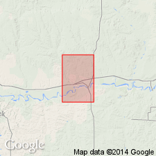
Flaxville gravel described in Wolf Point quadrangle, Montana. Unconformably overlies Fort Union strata and is unconformably overlain by glacial deposits. In some areas, underlies preglacial Wiota gravels (new). Average thickness about 40 feet. Very late Miocene or early Pliocene.
Source: US geologic names lexicon (USGS Bull. 1200, p. 1370-1371).

- Usage in publication:
-
- Flaxville formation*
- Modifications:
-
- Revised
- AAPG geologic province:
-
- Williston basin
Summary:
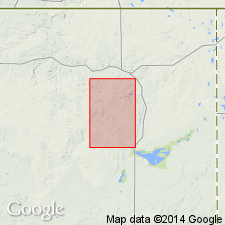
Mapped in northeast Sheridan Co, MT in the Williston basin. Rank term "formation" applied [rather than gravel]. Described as having basal coarse gravels, 20 to 50 ft thick of pebbles which average 1.5 inches in diameter and cobbles up to 1 ft in diameter, overlain by sandy and clayey strata [text], cemented by calcium carbonate locally and as a brown moderately well bedded sandy gravel [map]. Composed of 5 percent silt, 35 percent sand, 60 percent pebbles, and a few cobbles. The lithology [of the gravel] is 90 percent brown and red quartzite, and the remainder chalcedony and fragments of Fort Union. Is 30 to 100 ft thick. Occurs in mapped area over 9 sq mi at altitudes between 2,500 and 2,650 ft. Was probably once a continuous sheet. Unconformably overlies Paleocene Fort Union Formation. Overlain by glacial deposits. Of fluvial origin and of late Miocene or Pliocene age.
Source: GNU records (USGS DDS-6; Denver GNULEX).
For more information, please contact Nancy Stamm, Geologic Names Committee Secretary.
Asterisk (*) indicates published by U.S. Geological Survey authors.
"No current usage" (†) implies that a name has been abandoned or has fallen into disuse. Former usage and, if known, replacement name given in parentheses ( ).
Slash (/) indicates name conflicts with nomenclatural guidelines (CSN, 1933; ACSN, 1961, 1970; NACSN, 1983, 2005, 2021). May be explained within brackets ([ ]).

