- Usage in publication:
-
- Flat Top formation
- Modifications:
-
- First used
- Dominant lithology:
-
- Sandstone
- Siltstone
- Conglomerate
- AAPG geologic province:
-
- Basin-and-Range province
Summary:
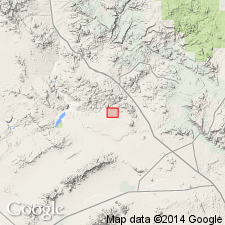
Recognized informally as middle part of upper of two Tertiary sequences in Anderson Mine area, secs 2 and 9-16, T11N, R10W, Yavapai Co, AZ in Basin-and-Range province. No type locality designated and origin of name not stated. Is a thick, upward-coarsening succession of arkosic sediments as much as 170 m thick, composed largely of grayish-orange to yellowish-brown arkosic siltstones, sandstones, and conglomerates interbedded with minor reworked tuffaceous siltstones. Most of the coarse clastics were derived from the Precambrian? crystalline complex beneath Anderson Mine formation (new)--the latter of which it overlies. Is overlain unconformably by a succession of agglomerate, conglomerate, and basalt. A minor amount of material was also derived from the older volcanic highlands (Reyner and others, 1956). The finer grained clastics fill an east-west-trending channel that is scoured as much as 100 m into the Anderson Mine section. Elsewhere in vicinity of Anderson Mine area, this phase of pre-Flat Top erosion appears to have eliminated much of the Miocene lacustrine section. May be correlative with part of Chapin Wash Formation of Lasky and Webber (1949). Based on relative stratigraphic position and associated structural events, age is probably middle to late? Miocene. Generalized geologic maps, cross sections, and geologic column.
Source: GNU records (USGS DDS-6; Denver GNULEX).
For more information, please contact Nancy Stamm, Geologic Names Committee Secretary.
Asterisk (*) indicates published by U.S. Geological Survey authors.
"No current usage" (†) implies that a name has been abandoned or has fallen into disuse. Former usage and, if known, replacement name given in parentheses ( ).
Slash (/) indicates name conflicts with nomenclatural guidelines (CSN, 1933; ACSN, 1961, 1970; NACSN, 1983, 2005, 2021). May be explained within brackets ([ ]).

