The National Geologic Map Database is migrating to a new infrastructure. We apologize for any service disruptions during this process.
|
|---|


- Usage in publication:
-
- Fitzwilliam granite*
- Modifications:
-
- [Principal reference]
- Dominant lithology:
-
- Granite
- AAPG geologic province:
-
- New England province
Summary:
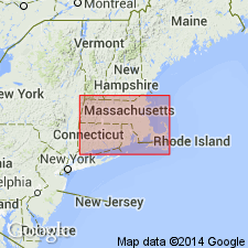
Pg. 238 and map. Fitzwilliam granite. Light-gray muscovite-biotite granite, of even, fine grain. Recognized in southwestern New Hampshire and extreme central northern Massachusetts; it just enters Massachusetts from Fitzwilliam, New Hampshire. Assigned to late Carboniferous or post-Carboniferous.
Named for town of town of Fitzwilliam, Cheshire Co., southwestern NH.
Source: US geologic names lexicons (USGS Bull. 896, p. 736; USGS Bull. 1200 p. 1359); supplemental information from GNU records (USGS DDS-6; Reston GNULEX).

- Usage in publication:
-
- Fitzwilliam Granite*
- Modifications:
-
- Overview
- Geochronologic dating
- AAPG geologic province:
-
- New England province
Summary:
Assigned as Fitzwilliam Granite of New Hampshire Plutonic Suite on 1:500,000-scale derivative map showing plutons and sample localities for isotopic dating. Not separately mapped on 1:250,000-scale geologic map. Isotope age of 383 +/-? Ma [Middle Devonian per time scale of Palmer (1983)] was reported by Hayward (1983, 1987). Report includes geologic map, cross sections, correlation chart, and four 1:500,000-scale derivative maps.
Source: GNU records (USGS DDS-6; Reston GNULEX).
For more information, please contact Nancy Stamm, Geologic Names Committee Secretary.
Asterisk (*) indicates published by U.S. Geological Survey authors.
"No current usage" (†) implies that a name has been abandoned or has fallen into disuse. Former usage and, if known, replacement name given in parentheses ( ).
Slash (/) indicates name conflicts with nomenclatural guidelines (CSN, 1933; ACSN, 1961, 1970; NACSN, 1983, 2005, 2021). May be explained within brackets ([ ]).