The National Geologic Map Database is migrating to a new infrastructure. We apologize for any service disruptions during this process.
|
|---|


- Usage in publication:
-
- Fittstown member
- Modifications:
-
- Original reference
- Dominant lithology:
-
- Calcarenite
- AAPG geologic province:
-
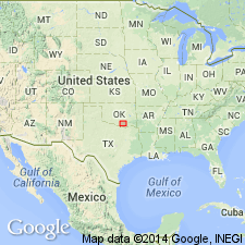
- Arkoma basin
Summary:
Pg. 6 (fig. 3), 45-47, fig. 4. Fittstown member of Bois d'Arc limestone. Name proposed for upper member of formation. Described as fossiliferous calcarenite with relatively low silt-clay content; beds 6 or 8 inches thick; locally contains nodules and lenses of chert. Thickness difficult to determine due to gradational nature of lower boundary; maximum thickness 75 feet (on Haragan Creek); on Lawrence uplift, thickness ranges from 25 to 60 feet. Overlies Cravatt member; underlies Frisco formation. Age is Silurian and Devonian.
Type locality: along Chimneyhill Creek, in SE/4 and NE/4 sec. 4, T. 2 N., R. 6 E., Pontotoc Co., south-central OK. Named from town of Fittstown.
Source: US geologic names lexicon (USGS Bull. 1200, p. 1359).
For more information, please contact Nancy Stamm, Geologic Names Committee Secretary.
Asterisk (*) indicates published by U.S. Geological Survey authors.
"No current usage" (†) implies that a name has been abandoned or has fallen into disuse. Former usage and, if known, replacement name given in parentheses ( ).
Slash (/) indicates name conflicts with nomenclatural guidelines (CSN, 1933; ACSN, 1961, 1970; NACSN, 1983, 2005, 2021). May be explained within brackets ([ ]).