The National Geologic Map Database is migrating to a new infrastructure. We apologize for any service disruptions during this process.
|
|---|


- Usage in publication:
-
- Fisher Creek Formation
- Modifications:
-
- Named
- Dominant lithology:
-
- Limestone
- Sandstone
- AAPG geologic province:
-
- Appalachian basin
Summary:
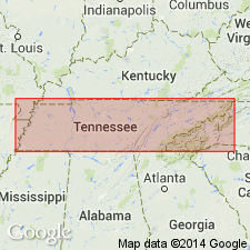
In the Greendale syncline in Hawkins and Grainger Cos., TN, Mississippian strata previously termed Newman Limestone (Hardeman and others, 1966) are isolated from the Newman Limestone in the Newman Ridge syncline. Part of these rocks are here named the Fisher Creek Formation. The Fisher Creek consists of limestone and subordinate sandstone and is subdivided into an informal lower member (informal Fisher Creek formation of Sanders, 1952), a middle sandstone member (informal Alumwell sandstone of Sanders, 1952), and an upper member (informal Marshall Creek formation of Sanders, 1952). Overlies the Gilliam Creek Limestone; sharply underlies the Fido Sandstone. Thickness is 450 m (1,500 ft). Age is Mississippian.
Source: GNU records (USGS DDS-6; Reston GNULEX).
For more information, please contact Nancy Stamm, Geologic Names Committee Secretary.
Asterisk (*) indicates published by U.S. Geological Survey authors.
"No current usage" (†) implies that a name has been abandoned or has fallen into disuse. Former usage and, if known, replacement name given in parentheses ( ).
Slash (/) indicates name conflicts with nomenclatural guidelines (CSN, 1933; ACSN, 1961, 1970; NACSN, 1983, 2005, 2021). May be explained within brackets ([ ]).