

- Usage in publication:
-
- Fish Lake Complex
- Modifications:
-
- Named
- Dominant lithology:
-
- Peridotite
- Gabbro
- AAPG geologic province:
-
- Alaska East-Central region
- Alaska Southern region
Summary:
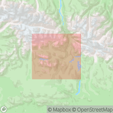
Type Locality: exposures of main dunite body in low hills around Fish Lake, Eureka Creek area, Mount Hayes A-4 and A-5 quads, east-central Alaska Range, AK. Composed of dunite, gabbro, and minor diorite. Forms intrusive bodies and related gabbro dikes, conforming to bedding trends. Compositional layering suggests differentiated layered sill. Is intrusive into, and between, Paxson Mountain Basalt (new) and Tangle Lakes Formation (new) (both in Amphitheater Group). Unconformably underlies Tertiary rocks. Is Jurassic age.
Source: GNU records (USGS DDS-6; Menlo GNULEX).
For more information, please contact Nancy Stamm, Geologic Names Committee Secretary.
Asterisk (*) indicates published by U.S. Geological Survey authors.
"No current usage" (†) implies that a name has been abandoned or has fallen into disuse. Former usage and, if known, replacement name given in parentheses ( ).
Slash (/) indicates name conflicts with nomenclatural guidelines (CSN, 1933; ACSN, 1961, 1970; NACSN, 1983, 2005, 2021). May be explained within brackets ([ ]).