- Usage in publication:
-
- Fire Creek Siltstone Member*
- Modifications:
-
- Named
- Biostratigraphic dating
- Dominant lithology:
-
- Siltstone
Summary:
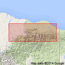
Named after Fire Creek where type section is exposed on west side of canyon at 69 deg 31'45"N, 145 deg 13'30"W, north flank of Brooks Range, northeastern AK. Is upper member (of 3) of Ivishak Formation of Sadlerochit Group. Good exposures mainly near Marsh Fork of Canning River, upper Kongakut River and along west fork of Aichilik River. Consists primarily of medium dark gray to black thin-bedded to massive siliceous siltstone that is commonly laminated, with minor silty shale and argillaceous sandstone present locally. Mud lumps, worm trails, and clay ironstone concretions are common. Is 110 ft thick at type; ranges from 0 to 440 ft thick. Conformably overlies Ledge Sandstone Member (new) (Ivishak Formation). Disconformably (?) underlies Shublik Formation. Age is Early Triassic based on ammonites of Romunderi Zone (Smithian) age.
Source: GNU records (USGS DDS-6; Menlo GNULEX).
For more information, please contact Nancy Stamm, Geologic Names Committee Secretary.
Asterisk (*) indicates published by U.S. Geological Survey authors.
"No current usage" (†) implies that a name has been abandoned or has fallen into disuse. Former usage and, if known, replacement name given in parentheses ( ).
Slash (/) indicates name conflicts with nomenclatural guidelines (CSN, 1933; ACSN, 1961, 1970; NACSN, 1983, 2005, 2021). May be explained within brackets ([ ]).

