The National Geologic Map Database is migrating to a new infrastructure. We apologize for any service disruptions during this process.
|
|---|


- Usage in publication:
-
- Finlay formation
- Modifications:
-
- Original reference
- Dominant lithology:
-
- Limestone
- Sandstone
- AAPG geologic province:
-
- Permian basin
Summary:
Pg. 47, geol. map. Finlay formation of Fredericksburg group. Almost entirely massive gray nonmagnesium limestone, but locally containing thin beds of brown sandstone. At least 300 feet exposed in Finlay Mountain region, but top not found. Top formation of Fredericksburg group. Overlies Cox formation and underlies residual soil and wash. Age is Early Cretaceous (Comanche).
Named from Finlay Mountains where formation is exposed in outer rim, El Paso Co. [now in Hudspeth Co.], western TX.
Source: US geologic names lexicon (USGS Bull. 896, p. 731).
- Usage in publication:
-
- Finlay Limestone
- Modifications:
-
- Revised
- AAPG geologic province:
-
- Orogrande basin
Summary:
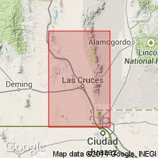
Revised--lower contact changed. Overlies the Lagrima Formation (first used) on the southeast edge of La Mesa in Sierra de Juarez, Dona Ana Co, NM in Orogrande basin. La Mesa is part of the Mesilla Bolson, bounded on the west by the East Potrillo Mountains, West Potrillo Mountains, Aden Hills, Sleeping Lady Hills, and Cedar Hills, and on the east by the Robledo Mountains (at the north tip of La Mesa) and the Rio Grande Valley. Lagrima Formation is equivalent to, but a greatly different facies of Cox Sandstone. Is of Cretaceous age.
Source: GNU records (USGS DDS-6; Denver GNULEX).
- Usage in publication:
-
- Finlay Limestone
- Modifications:
-
- Overview
- AAPG geologic province:
-
- Orogrande basin
Summary:
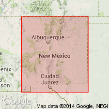
Mapped in Cerro de Cristo Rey, Dona Ana Co, NM, Orogrande basin. Forms distinctive cliffs along Rio Grande on northeast side of Cerro de Cristo Rey intrusion. Consists of nodular and massive limestone beds with thin shaly partings. Unit is 130 ft thick; base not exposed. (Thickness is 426 ft in Sierra de Juarez, Chihuahua, MX to south of study area). Finlay is oldest exposed unit in study area; is underlain by Lagrima Formation in subsurface. Underlies Del Norte Formation. Cross section. Finlay called Courchesne Formation by Strain (1968, West Texas Geol. Soc. Pub. 68-55). Early Cretaceous (Albian, Comanchean) age.
Source: GNU records (USGS DDS-6; Denver GNULEX).
For more information, please contact Nancy Stamm, Geologic Names Committee Secretary.
Asterisk (*) indicates published by U.S. Geological Survey authors.
"No current usage" (†) implies that a name has been abandoned or has fallen into disuse. Former usage and, if known, replacement name given in parentheses ( ).
Slash (/) indicates name conflicts with nomenclatural guidelines (CSN, 1933; ACSN, 1961, 1970; NACSN, 1983, 2005, 2021). May be explained within brackets ([ ]).